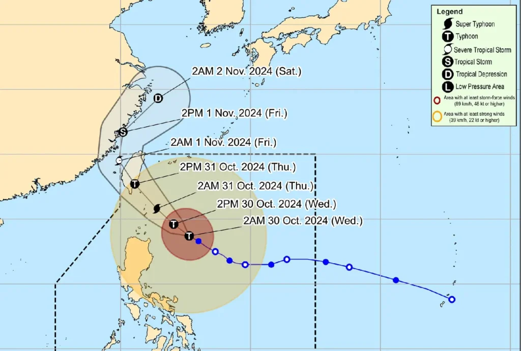
Typhoon Leon (#LeonPH) has intensified as it tracks west-northwest over the Philippine Sea, with maximum sustained winds reaching 165 km/h and gusts up to 205 km/h. As of 4:00 AM today, the typhoon’s center is located about 395 km east of Calayan, Cagayan.
Wind and Rain Warnings

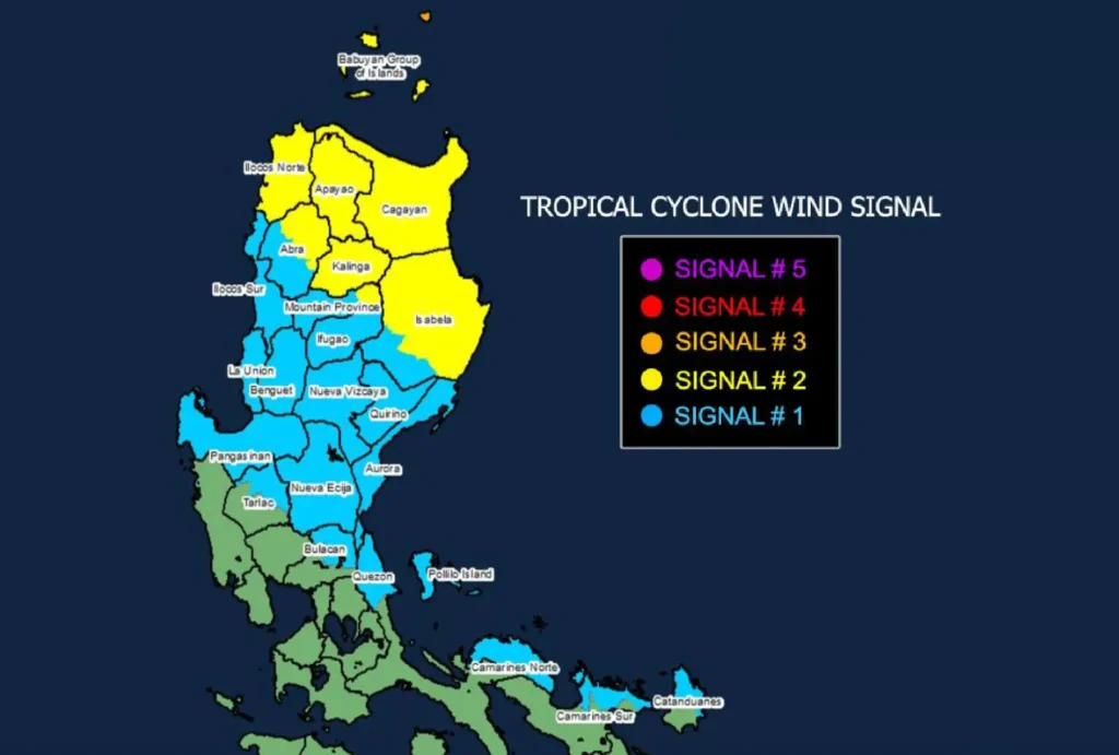
The Philippine Atmospheric, Geophysical, and Astronomical Services Administration (PAGASA) has issued several Tropical Cyclone Wind Signals across Luzon:
- Signal No. 3: Batanes and parts of the Babuyan Islands, with wind speeds of 89-117 km/h, posing a moderate to significant threat to life and property.
- Signal No. 2: The remaining areas of Babuyan Islands, Cagayan, parts of Isabela, Apayao, Kalinga, northern Abra, eastern Mountain Province, and Ilocos Norte, facing gale-force winds.
- Signal No. 1: Strong winds expected in regions including Quirino, Nueva Vizcaya, other parts of Isabela, Mountain Province, and several areas in Central Luzon.
Expected Hazards and Sea Conditions
With Leon forecasted to maintain or even intensify to super typhoon strength, moderate to significant impacts are anticipated, especially in coastal and mountainous areas.
A severe storm surge reaching up to 3.0 meters is expected in low-lying areas of Batanes, Babuyan Islands, and parts of Cagayan within the next 48 hours.
High to very rough seas are also expected, with waves reaching:
- Up to 12 meters in Batanes
- Up to 10 meters in Babuyan Islands and northeastern Cagayan
PAGASA has advised all mariners to remain in port due to hazardous sea conditions.
Path and Intensity Outlook

Leon is projected to make landfall along Taiwan’s eastern coast by tomorrow afternoon (October 31) before crossing the Taiwan Strait and moving toward the East China Sea, potentially reaching super typhoon status as it nears Batanes.
A landfall in Batanes has not been ruled out.
PAGASA urges residents in affected areas to remain vigilant, heed local warnings, and prepare for possible severe impacts as Typhoon Leon continues its intensified approach.
