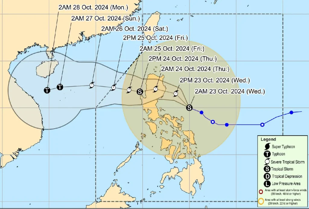
Tropical Storm Kristine has slightly intensified as it moves over the Philippine Sea, east of Quezon. As of 4:00 AM today, the center of Kristine was located 340 km east of Infanta, Quezon, or 180 km north-northeast of Virac, Catanduanes.
The storm now carries maximum sustained winds of 85 km/h, with gusts reaching up to 105 km/h, and a central pressure of 985 hPa.
Kristine is currently moving west-northwestward at 25 km/h, with strong to gale-force winds extending up to 850 km from its center.
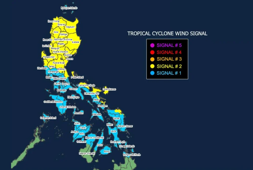
Tropical Cyclone Wind Signals (TCWS) are in effect, with TCWS No. 2 raised over several areas in Luzon and Visayas, indicating gale-force winds that pose minor to moderate threats to life and property.
Areas Under TCWS No. 2:

Luzon:
- Ilocos Norte, Ilocos Sur, La Union, Pangasinan, Apayao, Abra, Kalinga, Mountain Province, Ifugao, Benguet, Cagayan, Isabela, Quirino, Nueva Vizcaya, Aurora, Nueva Ecija, Tarlac, parts of Zambales, Quezon, and Camarines provinces.
Visayas:
- Northeastern Northern Samar, and northern Eastern Samar.
Meanwhile, TCWS No. 1, signaling strong winds, is in effect over parts of Luzon, Visayas, and Mindanao.
Rainfall and Coastal Hazards
Heavy rainfall is expected in areas under wind signals, and coastal communities in Ilocos, Cagayan, Aurora, and Catanduanes are advised to remain vigilant for potential storm surges.
A Gale Warning has also been issued over the seaboards of Luzon and Visayas, with sea travel deemed dangerous in these regions.
Forecast Track and Intensity

Kristine is expected to continue moving northwestward and will likely make landfall over Isabela or northern Aurora either tonight or early tomorrow morning.
After crossing Northern Luzon, it is forecast to emerge in the West Philippine Sea by Thursday afternoon, with a chance of re-intensification.
The storm is projected to exit the Philippine Area of Responsibility (PAR) by Friday, 25 October.
Residents in affected areas are urged to take precautionary measures, secure their properties, and follow local authorities’ instructions regarding evacuation and safety protocols.
