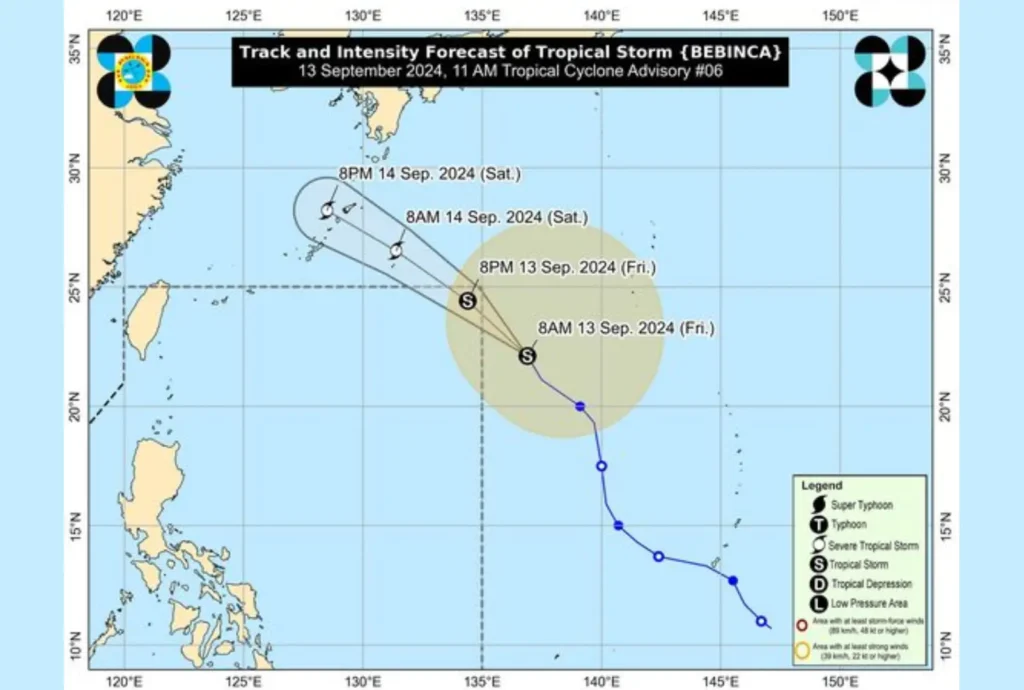
Tropical Storm “Bebinca” has weakened slightly as it continues to move across the Pacific Ocean. As of 10:00 AM today, the storm’s center was located approximately 1,500 kilometers east of Extreme Northern Luzon (22.6°N, 136.2°E). Despite the weakening, it continues to pose risks with its strong winds and rough sea conditions in parts of the country.
Intensity and Movement
Bebinca currently has maximum sustained winds of 85 km/h near its center, with gustiness reaching up to 105 km/h. The storm’s central pressure stands at 992 hPa. It is moving north-northwestward at a speed of 20 km/h, remaining far from the Philippine landmass.
Strong to gale-force winds extend outward up to 680 kilometers from the storm’s center, affecting areas well beyond its immediate vicinity.
Forecast and Outlook

The storm is expected to enter the Philippine Area of Responsibility (PAR) later this afternoon or evening, before exiting by tomorrow early morning. While Bebinca is likely to remain a tropical storm in the near term, it is forecast to re-intensify into a severe tropical storm by tomorrow and may even reach typhoon strength over the East China Sea.
Despite its distance, Bebinca is enhancing the Southwest Monsoon, which is expected to bring heavy rainfall in parts of the country. The public is advised to refer to Weather Advisory No. 6 for further details on the expected rainfall.
Sea Condition and Mariners Advisory
Due to the enhanced monsoon and Bebinca’s wind field, several coastal areas are expected to experience moderate to rough sea conditions over the next 24 hours:
- Wave heights of 1.5 to 3.5 meters are forecast in the seaboards of Palawan, Western Visayas, Negros Island, Central and Eastern Visayas, Caraga Region, Northern Mindanao, Zamboanga Peninsula, and the Davao Region.
- Wave heights of 1.0 to 3.0 meters are expected along the eastern seaboard of Eastern Visayas.
- Wave heights of 1.0 to 2.5 meters are forecast along the remaining seaboards of MIMAROPA, Ilocos Region, and Cagayan Valley.
Mariners of small seacrafts and motorbancas are strongly advised not to venture out to sea under these conditions, especially if operating with insufficient equipment or experience. Those aboard larger vessels are also urged to take precautionary measures while navigating.
Public and Authorities Advised to Stay Updated
The public, as well as disaster risk reduction offices, are advised to continue monitoring updates on Tropical Storm Bebinca. The next advisory is scheduled for 11:00 AM tomorrow, unless an intermediate update is deemed necessary.
