
Tropical Depression “Gener” is continuing its westward journey over the West Philippine Sea. As of 4:00 PM, the center of the storm was located approximately 235 kilometers west-northwest of Baguio City, with maximum sustained winds of 55 km/h, gusts up to 70 km/h, and a central pressure of 996 hPa. The tropical depression is moving westward at 30 km/h.
Tropical Cyclone Wind Signals (TCWS):
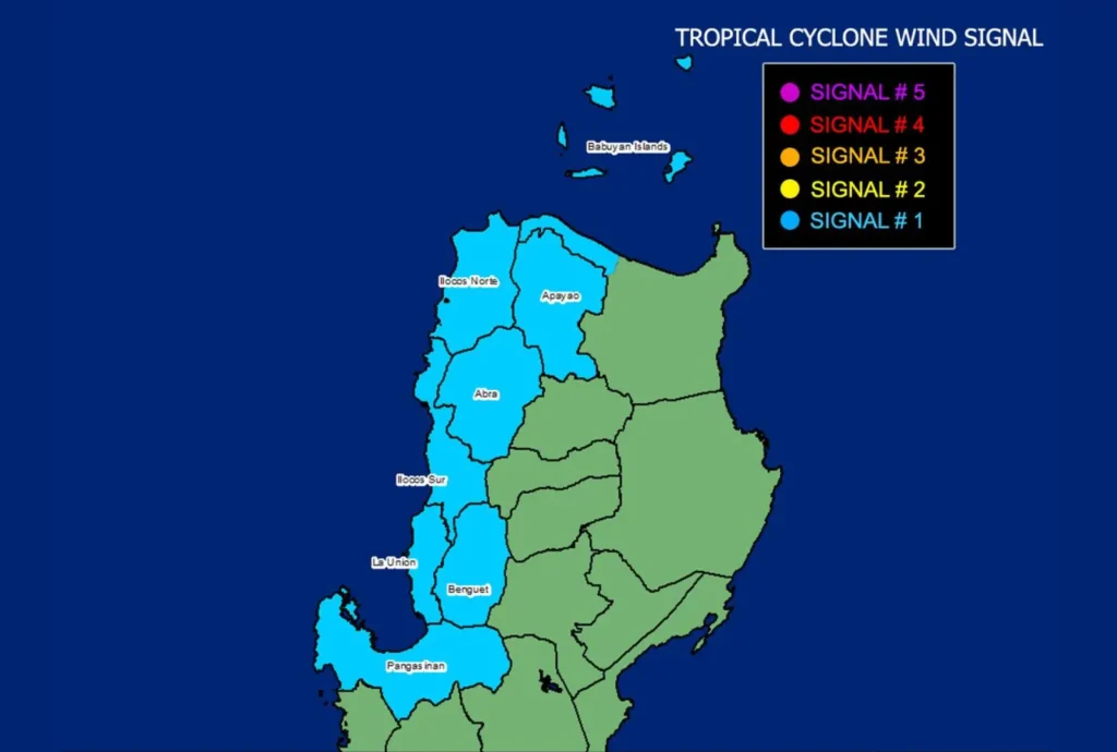
TCWS No. 1 is in effect over parts of Luzon, including Ilocos Norte, Ilocos Sur, La Union, and the western portion of Pangasinan. Winds between 39 and 61 km/h are expected in these areas, with minimal to minor threats to life and property over the next 36 hours.
Wind and Rainfall Impacts:
In addition to the storm’s direct impact, the Southwest Monsoon, enhanced by Tropical Depression “Gener” and Tropical Storm “Pulasan,” will bring strong to gale-force winds over Batanes, MIMAROPA, the Bicol Region, Visayas, and Mindanao today. These strong winds will expand tomorrow to include Zambales, Bataan, Pampanga, Bulacan, Metro Manila, and CALABARZON, and will continue over several regions through Thursday.
Coastal Hazards:
A Gale Warning remains in effect for several coastal waters along the western seaboard of Southern Luzon and parts of the Visayas. Mariners are advised against sea travel due to rough sea conditions, with wave heights reaching up to 3.5 meters in some areas.
Track and Intensity Forecast:
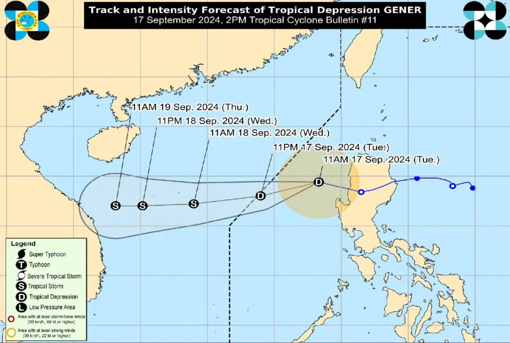
Tropical Depression “Gener” is expected to exit the Philippine Area of Responsibility (PAR) by early tomorrow morning. It may intensify into a tropical storm by then, continuing its westward trajectory over the West Philippine Sea.