
Super Typhoon Leon (Kong-rey) has intensified and continues to pose a significant threat to Northern Luzon as it barrels toward the area with powerful winds and life-threatening storm surges.
The latest report from PAGASA places the eye of Leon at approximately 350 km east of Calayan, Cagayan, carrying sustained winds of 185 km/h and gusts up to 230 km/h.
Current Movement and Affected Areas
Leon is moving west-northwestward at 10 km/h, with strong to typhoon-force winds extending up to 600 km from the center.
This vast reach means much of Northern Luzon, especially Batanes and Babuyan Islands, will experience severe weather effects.
PAGASA has raised several Tropical Cyclone Wind Signals:
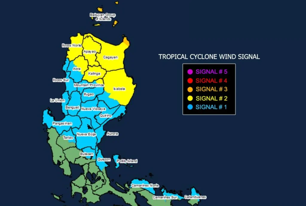
- Signal No. 3 in Batanes, parts of Babuyan Islands, and northeastern Cagayan, where wind speeds may reach 89-117 km/h. Areas under this signal are advised to brace for moderate to significant damage.
- Signal No. 2 in other parts of Babuyan Islands, mainland Cagayan, and parts of Isabela, Apayao, Kalinga, Abra, Mountain Province, and Ilocos Norte. These areas can expect gale-force winds (62-88 km/h) and are warned of minor to moderate impacts.
- Signal No. 1 has been raised in additional areas including Quirino, Nueva Vizcaya, and parts of Ifugao, Benguet, Ilocos, and Aurora, with strong winds of 39-61 km/h expected.
Additional Hazards and Warnings
The public is advised to stay alert for life-threatening storm surges reaching 2 to 3 meters in low-lying coastal areas of Batanes and Babuyan Islands.
Gale warnings are also in place for seaboards across Northern Luzon and parts of Central and Southern Luzon, where waves could reach up to 12 meters in certain locations.
Mariners and residents in coastal regions should refrain from sea travel and secure vessels until conditions improve.
Projected Path and Intensity
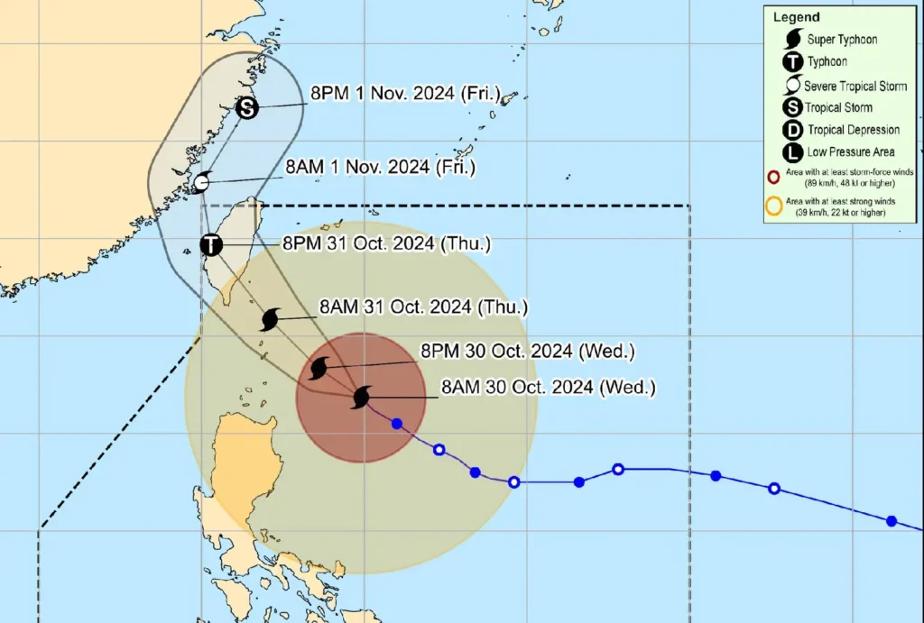
Leon is expected to continue its northwestward path and may make landfall along Taiwan’s eastern coast by October 31.
It will then weaken as it moves over Taiwan’s landmass before exiting the Philippine Area of Responsibility by November 1.
However, a direct impact on Batanes remains possible as Leon approaches its peak intensity.
PAGASA advises residents in the affected areas to remain vigilant, heed official warnings, and monitor the next bulletin at 2:00 PM for updates.