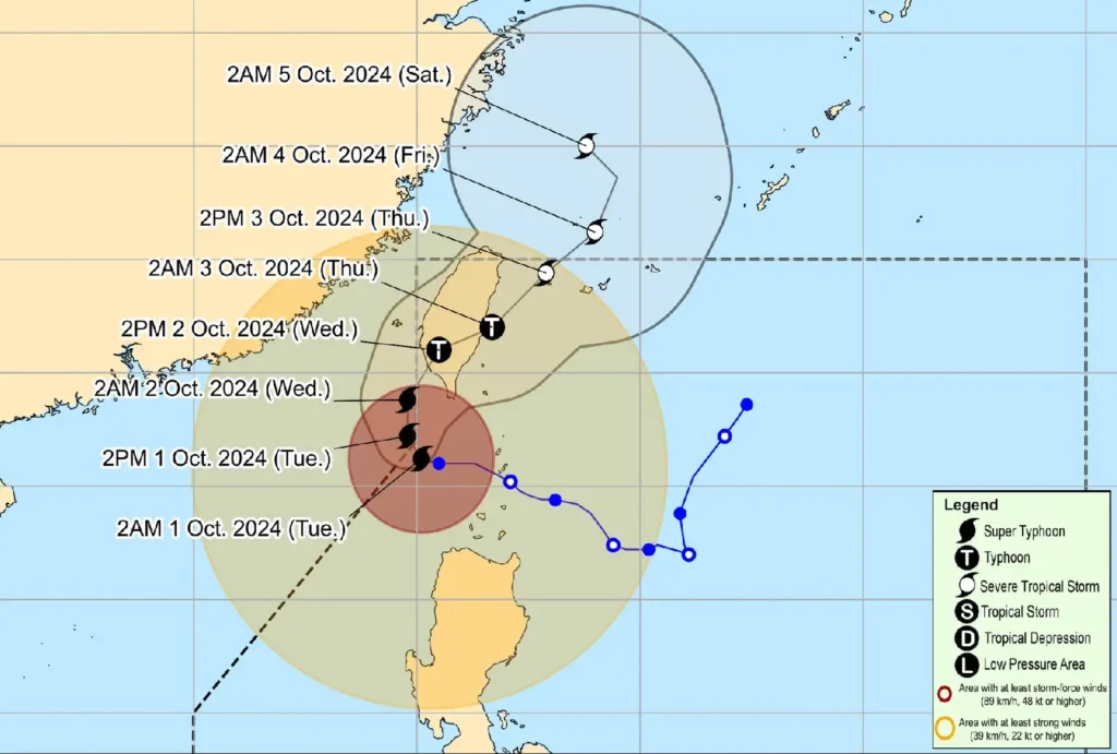
October 1, 2024 (5:00 AM) – Super Typhoon Julian (#JulianPH) has strengthened further as it continues to move slowly across the Luzon Strait. As of 4:00 AM, the center of the storm was located 205 km west of Itbayat, Batanes, with maximum sustained winds reaching 185 km/h and gusts up to 230 km/h. Strong to typhoon-force winds now extend up to 620 km from the storm’s center, prompting increased warnings across northern Luzon.
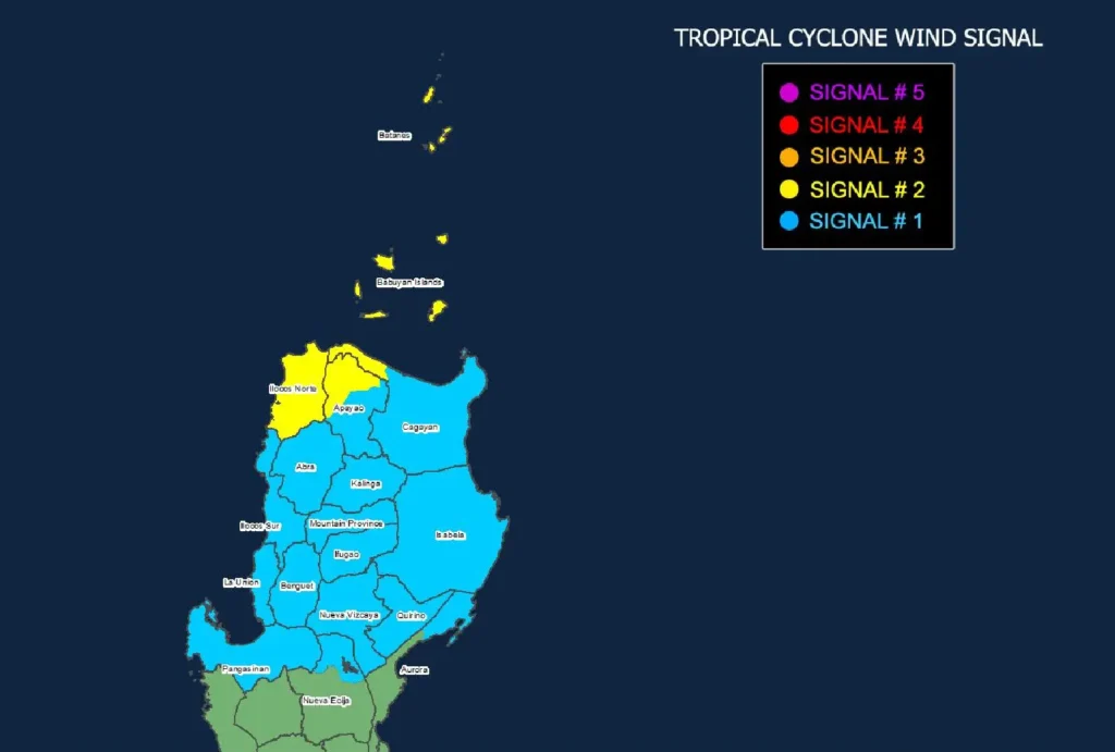
Wind Signals in Effect:

- TCWS No. 2: Batanes, Babuyan Islands, and parts of Ilocos Norte and mainland Cagayan will experience gale-force winds (62-88 km/h). Residents are warned of minor to moderate impacts to life and property within the next 24 hours.
- TCWS No. 1: Strong winds (39-61 km/h) are expected over Ilocos Norte, Ilocos Sur, La Union, Pangasinan, and other northern Luzon provinces. Minimal to minor impacts are anticipated.
Additional Hazards:
- Heavy Rainfall: Super Typhoon Julian may bring heavy rainfall to the Ilocos Region, Cordillera, and parts of Cagayan Valley. Flash floods and landslides are possible, particularly in mountainous areas.
- Storm Surge: A storm surge warning is in effect for low-lying areas in Batanes and Babuyan Islands, with a moderate to high risk of life-threatening coastal flooding in the next 48 hours.
- Sea Conditions: Gale warnings have been issued for northern Luzon’s coastal waters, with wave heights of up to 7 meters in Batanes and 6 meters in Babuyan Islands and Ilocos Norte. All sea travel is considered extremely dangerous, and mariners are advised to stay in port.
Track and Intensity Outlook:

Super Typhoon Julian is forecast to turn northwestward today, potentially making landfall along the southwestern coast of Taiwan by October 2. The storm is expected to slightly weaken due to its interaction with Taiwan’s mountainous terrain and may be downgraded to a severe tropical storm by Thursday, October 3.
Residents in affected areas are urged to take precautionary measures and follow evacuation orders from local authorities. Stay updated with PAGASA for the latest weather advisories.
