
Severe Tropical Storm PAOLO has intensified as it barrels westward towards the Philippine archipelago, prompting authorities to raise Tropical Cyclone Wind Signal (TCWS) No. 3 over several provinces in Northern Luzon.
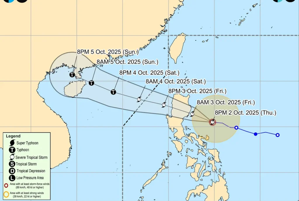
As of 10:00 PM, the center of the storm was located 320 kilometers east of Baler, Aurora, packing maximum sustained winds of 95 km/h near the center and gustiness of up to 115 km/h.
Moving swiftly at 30 km/h, the storm is forecast to make landfall over Isabela or the northern portion of Aurora on Friday morning.
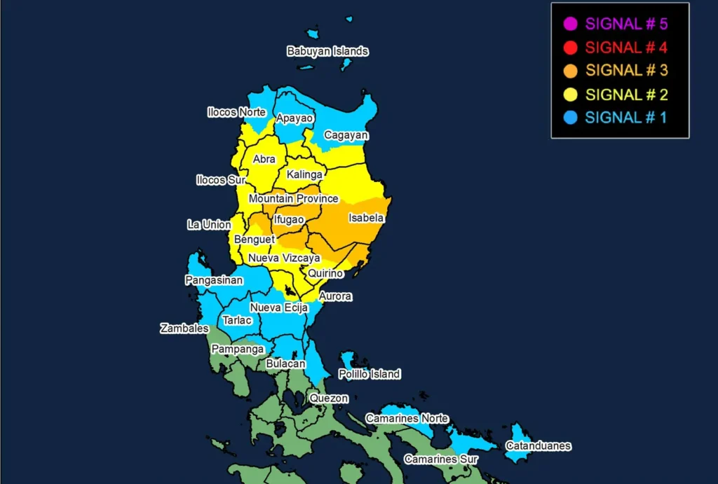
Consequently, TCWS No. 3 is now in effect for the extreme northern part of Aurora, central and southern Isabela, and the northern portions of Quirino, Nueva Vizcaya, Ifugao, Mountain Province, and Benguet, warning of storm-force winds that pose a moderate to significant threat to life and property.
Meanwhile, TCWS No. 2 has been hoisted over a wider area, including the rest of Isabela, Quirino, Nueva Vizcaya, Ilocos Sur, La Union, and parts of Cagayan, Aurora, and Benguet, where gale-force winds are anticipated.
TCWS No. 1 remains active for the rest of mainland Cagayan, Pangasinan, the northern part of Quezon including Polillo Islands, and other nearby provinces expecting strong winds within 36 hours.
PAGASA has also issued a stern warning for a moderate to high risk of life-threatening storm surge, with peak heights reaching up to 3.0 meters in the low-lying coastal areas of Ilocos Norte, Ilocos Sur, Cagayan, Isabela, Aurora, and Quezon.
A Gale Warning is currently in effect over the seaboards of Northern Luzon and the eastern seaboard of Central Luzon, making sea travel risky for all types of vessels.
The weather bureau has not ruled out the possibility of PAOLO intensifying into a typhoon before it hits land, which could necessitate raising the warning to Wind Signal No. 4.
After crossing the landmass, the storm is expected to emerge over the West Philippine Sea by Friday afternoon and exit the Philippine Area of Responsibility (PAR) by Saturday morning.
The public and disaster risk reduction and management offices are advised to take all necessary precautions and monitor all official updates from PAGASA.