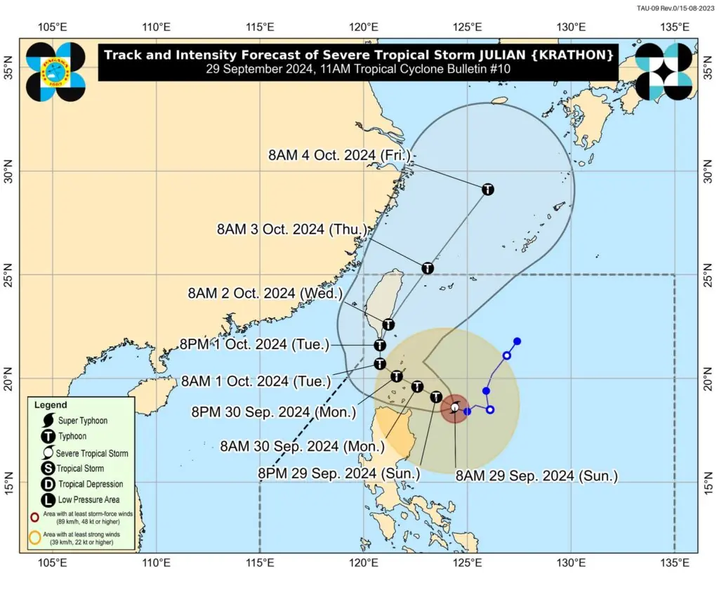
Severe Tropical Storm Julian has intensified over the Philippine Sea, currently located approximately 290 km east-northeast of Aparri, Cagayan.
With maximum sustained winds of 110 km/h and gusts up to 135 km/h, the storm is moving west-northwest at a slow pace.
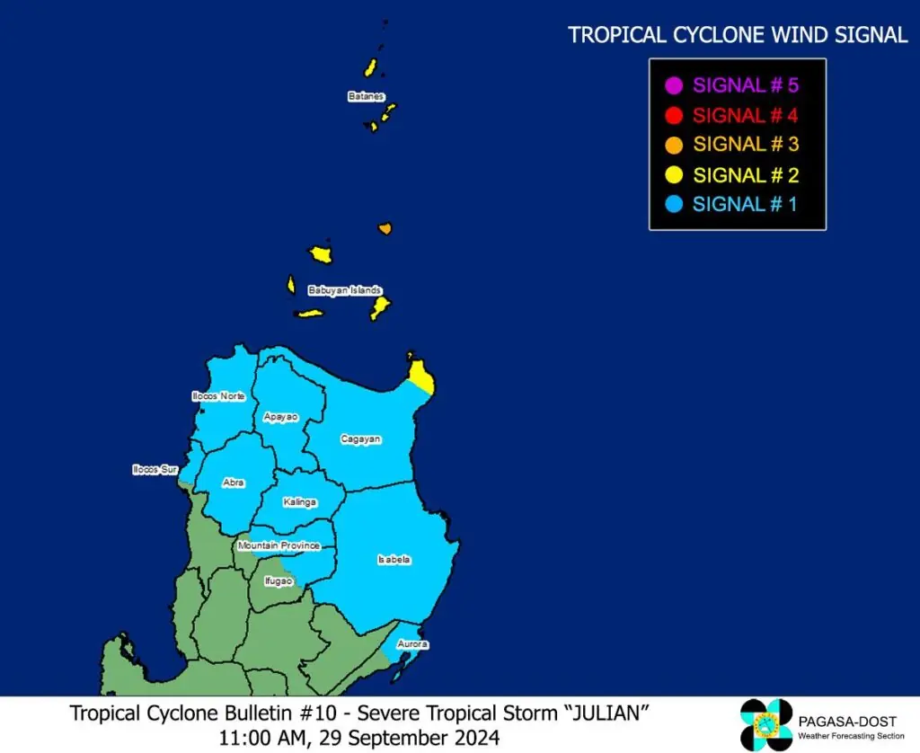
Tropical Cyclone Wind Signals (TCWS) in Effect:

- Signal No. 3: Gale-force winds are expected in the northeastern portion of the Babuyan Islands, posing a moderate to significant threat to life and property.
- Signal No. 2: Gale-force winds are also impacting Batanes and parts of mainland Cagayan, with a minor to moderate threat to life and property.
- Signal No. 1: Strong winds are forecasted across the rest of Cagayan, Isabela, and various northern provinces, indicating a minimal to minor threat.
Heavy Rainfall and Winds: Residents in areas under TCWS are warned to prepare for strong winds, especially in coastal and upland regions. Heavy rainfall is anticipated, and local wind patterns may exacerbate conditions.
Coastal Conditions: A gale warning is in effect for the northern and eastern seaboards of Northern Luzon, with very rough seas. Mariners are advised to avoid sea travel due to dangerous conditions, particularly around Batanes and Babuyan Islands.
Forecast Track

Julian is expected to move towards the Batanes-Babuyan Islands area, with a likely landfall tomorrow, September 30. The storm may to typhoon status later today, with a potential for rapid intensification.
Precautions: Residents in vulnerable areas should heed local advisories and take necessary precautions to ensure safety. Monitor updates from PAGASA for the latest developments.
