Batanes and Nearby Areas Brace for Violent Conditions as Super Typhoon Leon Approaches
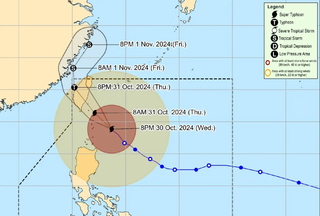
Super Typhoon Leon, also known internationally as Kong-Rey, is nearing extreme northern Luzon, bringing violent conditions to Batanes.
As of 10:00 PM, the eye of Typhoon Leon was located 140 km east of Basco, Batanes, with maximum sustained winds of 185 km/h and gusts reaching up to 230 km/h.
The typhoon, which has a central pressure of 925 hPa, is moving northwestward at 15 km/h.
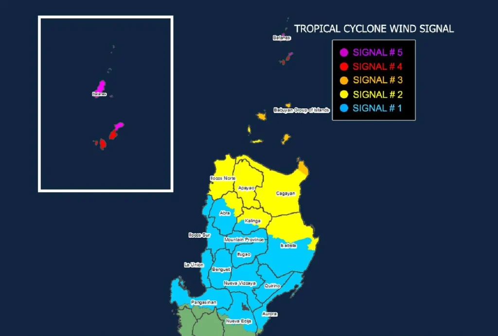
Tropical Cyclone Wind Signals

TCWS No. 5
- Areas affected: Northern and eastern Batanes (Itbayat, Basco)
- Expected wind speed: 185 km/h
- Impact: Extreme threat to life and property
TCWS No. 4
- Areas affected: Remaining areas of Batanes
- Expected wind speed: 118–184 km/h
- Impact: Significant to severe threat to life and property
TCWS No. 3
- Areas affected: Eastern Babuyan Islands, northeastern Cagayan (Santa Ana)
- Expected wind speed: 89–117 km/h
- Impact: Moderate to significant threat
Other Affected Areas
Strong winds reaching up to gale-force levels are expected across parts of northern Luzon, including Cagayan, Isabela, Apayao, Kalinga, and Abra, under TCWS No. 2. These areas face a minor to moderate threat.
The rest of Isabela, Quirino, Nueva Vizcaya, and central Luzon provinces are under TCWS No. 1, where strong winds may pose minimal to minor threats.
Heavy Rainfall and Coastal Hazards:
- Storm Surge Warning: A potential 3.0-meter life-threatening storm surge may impact the low-lying coastlines of Batanes and Babuyan Islands.
- Coastal Waters: Rough to very high seas expected, up to 14 meters in Batanes, making sea travel extremely risky. Mariners are advised to seek shelter.
Forecast Path and Outlook:

Leon will likely pass near Batanes tonight through tomorrow morning and is expected to make landfall over Taiwan by tomorrow afternoon, weakening as it moves north toward the East China Sea.
