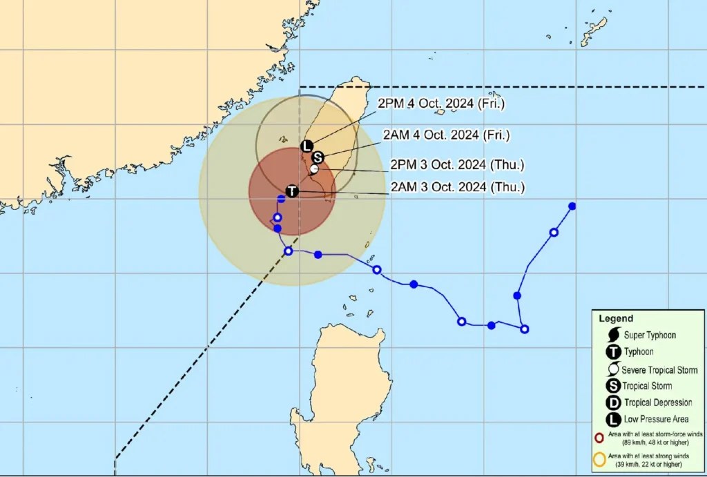
Typhoon Julian (International Name: KRATHON) is weakening as it slowly moves northeastward toward Taiwan. As of 4:00 AM today, the center of Typhoon Julian was located 265 km northwest of Itbayat, Batanes, outside the Philippine Area of Responsibility (PAR).
The storm currently has maximum sustained winds of 140 km/h, with gusts reaching up to 170 km/h, and a central pressure of 965 hPa.
Affected Areas

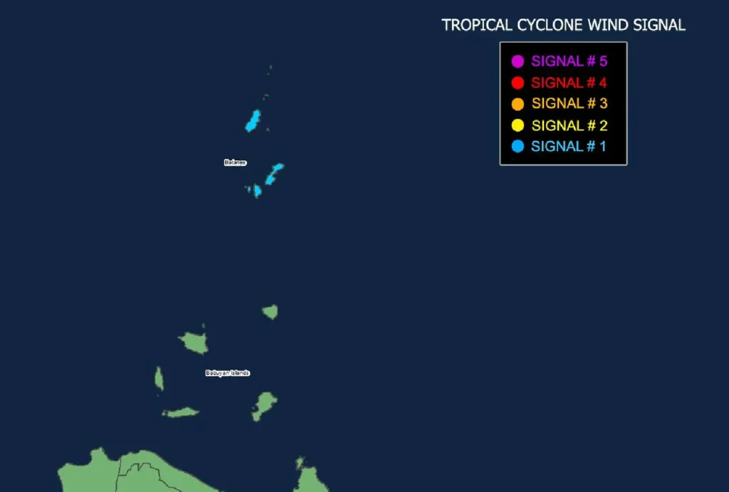
Typhoon signals are in place, with Tropical Cyclone Wind Signal No. 1 raised over Batanes, indicating strong winds with speeds of 39 to 61 km/h. Winds are expected to be stronger in coastal and upland areas, although the threat to life and property remains minimal to minor.
Coastal Waters Warning
A Gale Warning is in effect over the northern seaboard of Northern Luzon, where sea conditions are very rough, with waves reaching up to 4.5 meters.
Sea travel remains risky for small vessels, and mariners are advised to stay in port. Moderate to rough seas, with waves as high as 4.0 meters, are also expected in the coastal areas of the Babuyan Islands, Ilocos Norte, Zambales, and other nearby regions.
Track and Intensity Outlook

Typhoon Julian is forecasted to make landfall in southwestern Taiwan today. As it moves closer, the typhoon is expected to weaken due to the cold wind flow over the East China Sea and the upwelling of cooler waters in its path.
After making landfall, Julian may move erratically over Taiwan before eventually weakening into a remnant low by tomorrow, October 4.
Public Safety
Residents of Batanes and other affected areas are urged to take necessary precautions and heed evacuation instructions from local authorities.
Continuous monitoring of weather advisories from PAGASA is advised, especially for those in high-risk areas.
