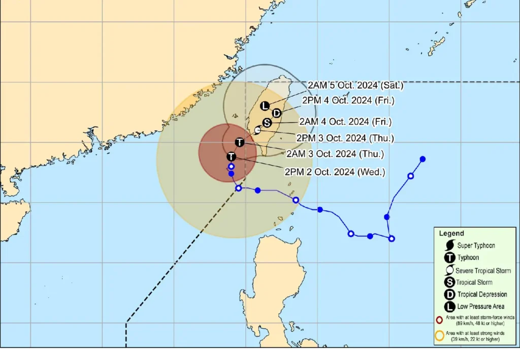
Typhoon Julian, also known as Krathon, has slightly accelerated as it moves northward toward southern Taiwan. As of 4:00 PM today, the center of the eye of Typhoon Julian was located approximately 275 km west-northwest of Itbayat, Batanes, at coordinates 22.0°N, 119.5°E.
Current Conditions
- Maximum Sustained Winds: 165 km/h
- Gustiness: Up to 205 km/h
- Central Pressure: 945 hPa
- Movement: Northward at 15 km/h
Strong to typhoon-force winds extend outward up to 380 km from the storm’s center, prompting the issuance of Tropical Cyclone Wind Signal No. 1 in certain areas.
Affected Areas

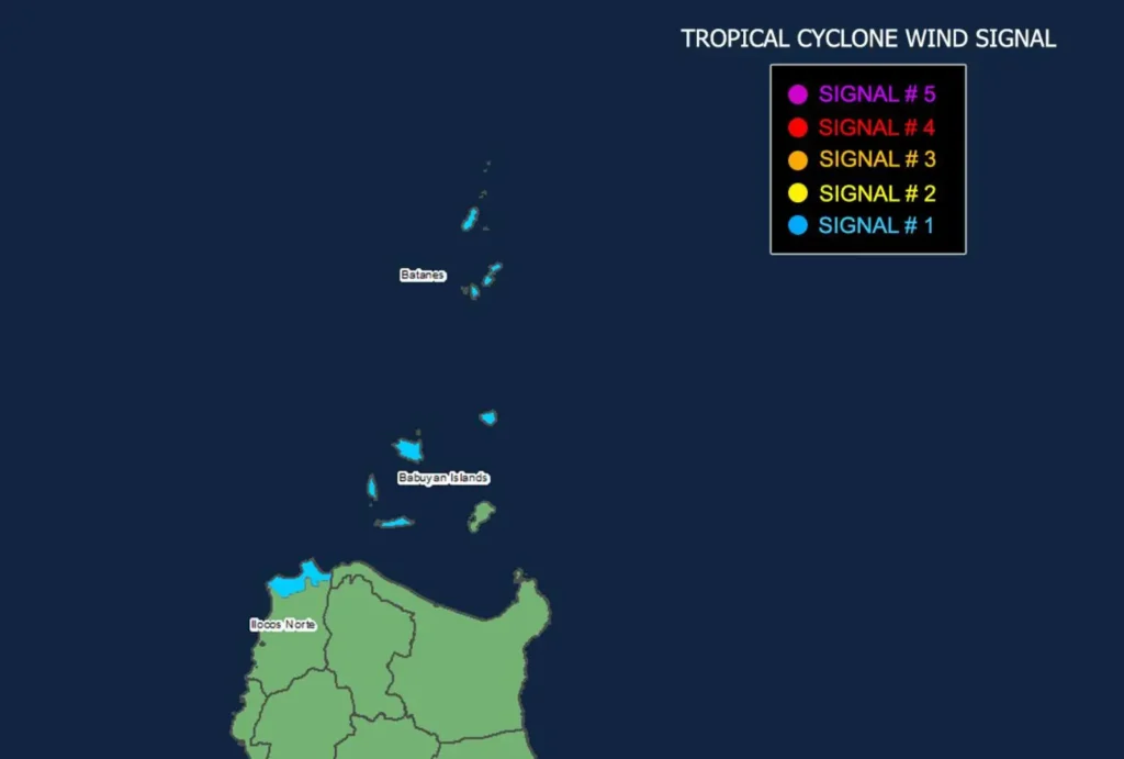
The following regions are under Wind Signal No. 1, which indicates strong winds with potential impacts:
- Luzon:
- Batanes
- Babuyan Islands (including Calayan Island, Dalupiri Island, and Fuga Island)
- Northern and western portions of Ilocos Norte (Bangui, Burgos, Pagudpud)
Wind Impact
- Wind Threat: Strong winds
- Warning Lead Time: 36 hours
- Potential Impacts: Minimal to minor threat to life and property
Residents in the affected areas are advised to prepare for possible disruptions and to secure any loose items outdoors.
Other Hazards
Heavy Rainfall Outlook: Refer to Weather Advisory No. 28F issued at 5:00 PM for details on expected rainfall due to Typhoon Julian.
Severe Winds: Local winds may be enhanced in coastal and mountainous areas. Areas sheltered from prevailing winds may experience weaker conditions.
Coastal Warnings
A Gale Warning is in effect for the northern seaboard of Northern Luzon:
- Very Rough Seas: Up to 4.5 m in Batanes and Babuyan Islands, posing risks for most vessels, including small seacrafts and motorbancas.
- Moderate to Rough Seas:
- Up to 4.0 m over the seaboard of Ilocos Norte
- Up to 3.5 m over other seaboards of Ilocos Region and northeastern Cagayan
- Up to 3.0 m over Zambales
- Up to 2.5 m over remaining Cagayan seaboards
Mariners, particularly those operating small vessels, are advised to remain in port or seek safe harbor.
Track and Intensity Outlook

Typhoon Julian is expected to turn northeastward towards the southwestern coast of Taiwan and is forecast to make landfall by tomorrow morning (October 3).
After landfall, Julian is projected to move slowly over Taiwan and may weaken significantly, possibly becoming a remnant low by Saturday (October 5).
No direct effects are anticipated for the Philippines, except for Batanes, which lies in close proximity to Taiwan.
Preparedness Advisory:
Residents in areas susceptible to severe weather hazards are urged to take precautions and follow the guidance of local officials regarding evacuations and other safety measures.
Stay informed through local PAGASA updates for heavy rainfall warnings and other severe weather information specific to your area.
