Typhoon Ofel (Usagi) continues to strengthen as it moves west-northwestward over the waters east of Isabela.
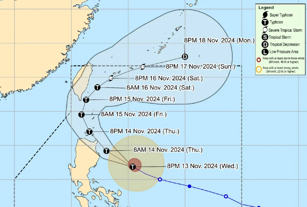
As of 1:00 AM, the eye of Typhoon Ofel was located 225 km east of Casiguran, Aurora, or 265 km east of Echague, Isabela, carrying maximum sustained winds of 150 km/h near the center, gusts up to 185 km/h, and a central pressure of 960 hPa.
The typhoon is moving at 25 km/h, with typhoon-force winds extending 320 km from the center.
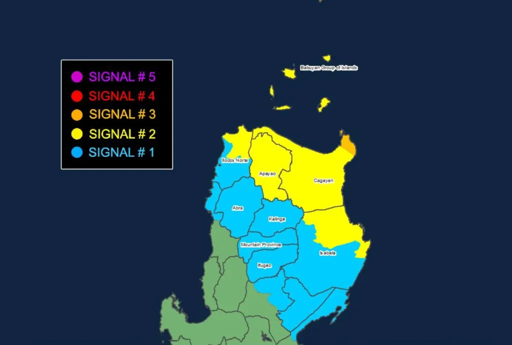
Tropical Cyclone Wind Signals in Effect

- Signal No. 3: Storm-force winds (89–117 km/h) within 18 hours are expected over northeastern mainland Cagayan, including Santa Ana and Gonzaga, and the southeastern part of Babuyan Islands (Camiguin Is.). Significant threats to life and property are anticipated.
- Signal No. 2: Gale-force winds (62–88 km/h) are forecast within 24 hours over southern Batanes, Babuyan Islands, remaining parts of mainland Cagayan, northern and eastern Isabela, Apayao, and northern Ilocos Norte. Impacts may include minor to moderate damage.
- Signal No. 1: Strong winds (39–61 km/h) will affect Batanes, the rest of Isabela, Quirino, northern Nueva Vizcaya, Kalinga, Abra, Mountain Province, Ifugao, the rest of Ilocos Norte, parts of Ilocos Sur, and northern Aurora within 36 hours. Minor impacts are expected.
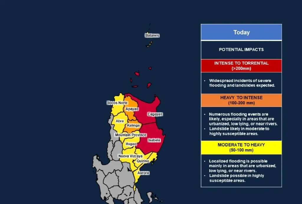
Heavy Rainfall and Wind Threats

Communities should stay alert for possible heavy rainfall as indicated in Weather Advisory No. 27.
Enhanced winds may affect coastal and mountainous areas, posing a risk of significant impacts under Wind Signal No. 3.
Storm Surge Warning
Coastal areas of Batanes, Ilocos Norte, Ilocos Sur, Cagayan, Babuyan Islands, Isabela, and northern Aurora are at risk of life-threatening storm surges with peak heights of 1.0 to 3.0 meters.
Residents in these areas should heed warnings and take appropriate safety measures.
Hazardous Sea Conditions
A Gale Warning remains in effect for the northern and eastern seaboards of Northern and Central Luzon. Waves may reach heights of up to 10 meters in some areas, making sea travel extremely dangerous.
Mariners are advised to stay in port and seek safe shelter until conditions improve.
Track and Intensity Outlook

Typhoon Ofel is expected to make landfall along the eastern coast of Cagayan or Isabela this afternoon and move into the Babuyan Channel tonight.
It will then head north-northwest, possibly passing close to Babuyan Islands before curving northeastward over the sea east of Taiwan toward Ryukyu Islands.
The storm could reach super typhoon intensity due to favorable conditions, although a weakening trend is likely once it nears Taiwan.
