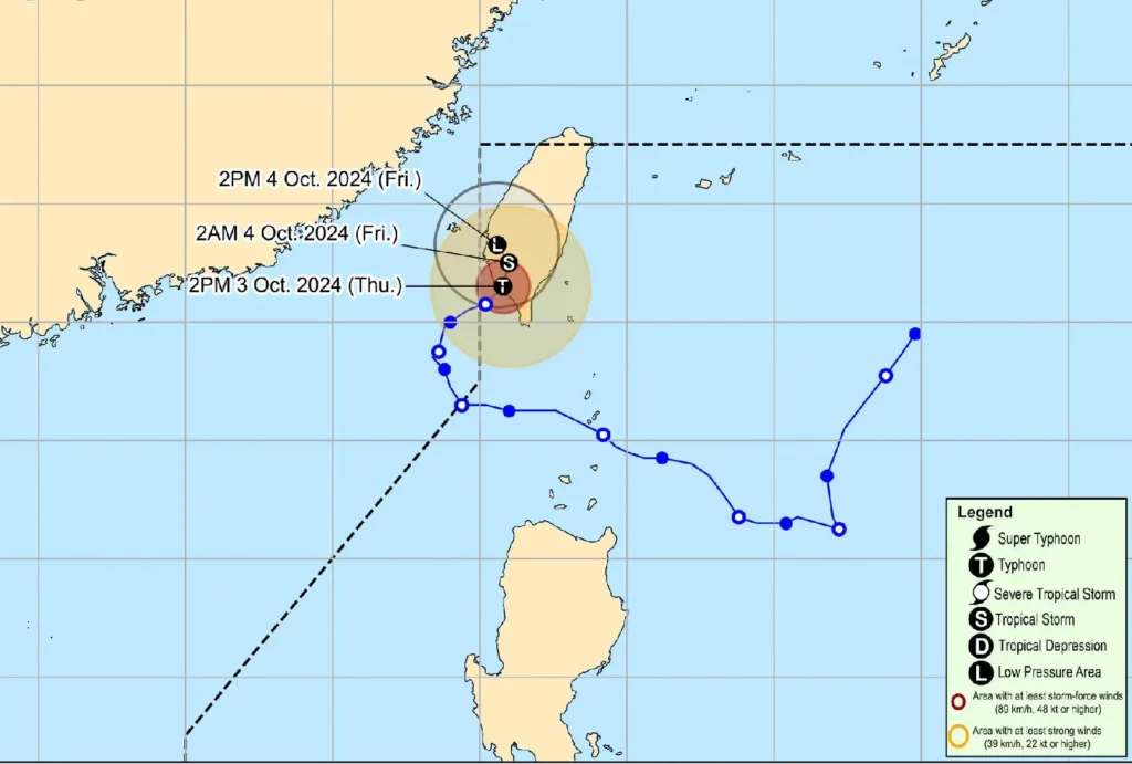
Typhoon Julian (international name: Krathon) has made landfall over southern Taiwan, as confirmed by the latest bulletin from the Philippine Atmospheric, Geophysical and Astronomical Services Administration (PAGASA).
At 4:00 PM today, the eye of Typhoon Julian was located 255 km north-northwest of Itbayat, Batanes.
The storm remains powerful, with maximum sustained winds of 120 km/h near the center, gusts reaching up to 165 km/h, and a central pressure of 975 hPa. Julian is currently moving east-northeast at 10 km/h.
No Tropical Cyclone Wind Signals Hoisted
While the typhoon has re-entered the Philippine Area of Responsibility (PAR), no tropical cyclone wind signals are in effect, and no direct impact on the country is expected.
Sea Conditions and Coastal Hazards
However, mariners and small seacrafts are advised to avoid sea travel due to moderate to rough seas in the following coastal areas:
- Batanes, Babuyan Islands, Ilocos Norte: Up to 4.0 meters
- Ilocos Region (remaining seaboards): Up to 3.5 meters
- Mainland Cagayan, Zambales, Bataan: Up to 3.0 meters
- Lubang Island, Calamian Islands, Kalayaan Islands: Up to 2.5 meters
Vessels, especially small motorbancas, are cautioned to stay in port due to the dangerous sea conditions.
Forecast Track and Intensity Outlook

Typhoon Julian is expected to weaken as it interacts with Taiwan’s rugged terrain and cooler waters in the region.
It is forecast to become a remnant low by tomorrow, October 4.
No significant weather disturbances are forecast for the Philippines, aside from rough seas affecting coastal regions in the north.
The public, especially those in coastal areas, are advised to remain cautious and follow local authorities’ instructions for safety.
