
Tropical Storm Paolo slightly intensified while hovering over the Philippine Sea and is forecast to make landfall over southern Isabela or northern Aurora by Friday morning.
As of 10:00 AM, the storm’s center was located 575 kilometers east of Infanta, Quezon, with maximum sustained winds of 75 km/h and gusts reaching up to 90 km/h.
Paolo is moving west-northwestward at 20 km/h, with strong to gale-force winds extending up to 250 kilometers from its center.
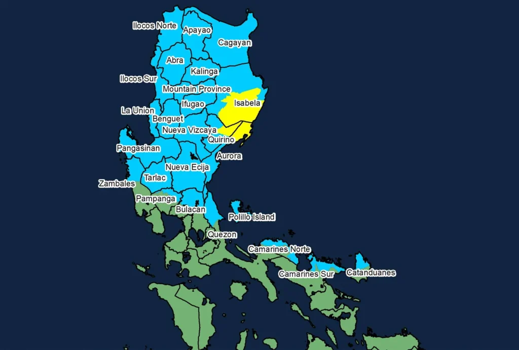
PAGASA has raised Tropical Cyclone Wind Signal No. 2 over parts of Isabela, Quirino, and Aurora, warning of gale-force winds and moderate threats to life and property.
Signal No. 1 is in effect across multiple provinces in Northern and Central Luzon, including Cagayan, Ilocos Region, Cordillera, and parts of Quezon and Catanduanes, due to strong winds.
There is a moderate risk of storm surge reaching 1.0 to 2.0 meters in low-lying coastal areas of Ilocos Norte, Cagayan, Isabela, Aurora, Quezon, Camarines Norte, Camarines Sur, and Catanduanes.
Gale warnings may be issued over Northern and Central Luzon’s seaboards this afternoon, with sea conditions expected to be very rough, especially along Isabela’s coast where waves may reach up to 6.0 meters.
Sea travel remains risky for all vessels, and mariners are advised to stay in port or seek shelter until conditions improve.
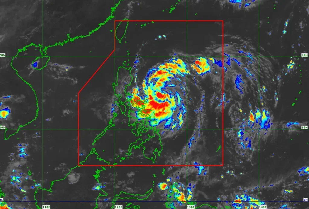
Paolo is expected to intensify into a severe tropical storm tonight and may reach typhoon category once it crosses Northern Luzon and enters the West Philippine Sea.
The highest possible wind signal during Paolo’s passage is Signal No. 3, though Signal No. 4 is not ruled out depending on further intensification.
PAGASA urges residents and disaster response units to prepare for heavy rainfall, severe winds, and coastal inundation, and to follow evacuation orders from local authorities.
The public is advised to monitor updates from PAGASA and local weather advisories for area-specific warnings and instructions.