
As of 5:00 AM on September 18, 2024, Tropical Storm Helen (international name: Pulasan) is steadily moving west northwestward over the Philippine Sea. The storm’s center is located approximately 1,150 kilometers east-northeast of Extreme Northern Luzon, with maximum sustained winds of 85 km/h and gustiness reaching up to 105 km/h. The storm is moving at a pace of 25 km/h, carrying strong to gale-force winds extending 650 kilometers from its center.
No Tropical Cyclone Wind Signal in Effect
As of the latest advisory, no Tropical Cyclone Wind Signal has been raised. However, Tropical Storm Helen is expected to enhance the Southwest Monsoon (Habagat), which is already intensified by another system, Tropical Storm Gener. This could lead to adverse weather conditions in various parts of the country.
Areas Affected by Enhanced Southwest Monsoon Winds
- Today (September 18): Zambales, Bataan, Pampanga, Bulacan, Metro Manila, CALABARZON, MIMAROPA, Bicol Region, Visayas, Zamboanga Peninsula, Northern Mindanao, Caraga, and Davao Region.
- Tomorrow (September 19): Ilocos Region, Isabela, Aurora, Zambales, Bataan, Metro Manila, CALABARZON, MIMAROPA, Bicol Region, Western Visayas, Negros Island, and Zamboanga Peninsula.
- Thursday (September 20): Ilocos Region, Isabela, Aurora, Zambales, Bataan, Cavite, Batangas, Quezon, Occidental Mindoro, Marinduque, and Romblon.
Sea Condition and Gale Warnings
A Gale Warning remains in effect for the western seaboard of Central and Southern Luzon, and the Visayas, where rough seas are expected. Sea travel is dangerous for small vessels, particularly motorbancas. Mariners are advised to exercise caution, especially in the coastal waters of Cagayan Valley, Zamboanga Peninsula, Caraga, and the Ilocos Region, where wave heights may reach up to 3.5 meters.
Track and Intensity Outlook
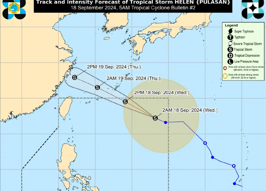
Tropical Storm Helen is forecast to continue its west-northwestward path, likely exiting the Philippine Area of Responsibility (PAR) by late this afternoon or evening. Helen is expected to stay far from Philippine landmass and may weaken over the East China Sea.
While Helen will not directly impact the country, the public is advised to remain vigilant as the enhanced Southwest Monsoon may still bring hazardous conditions, particularly in coastal and upland areas. Residents are encouraged to heed the warnings and instructions of local officials.
For updated rainfall advisories and other weather information, please monitor PAGASA bulletins.