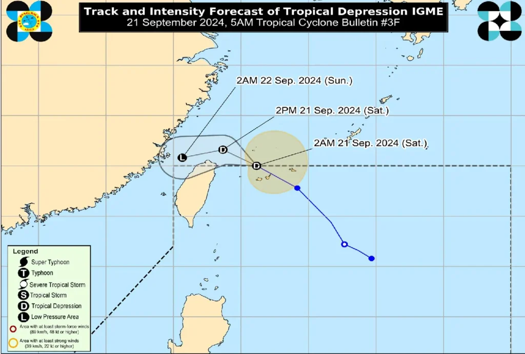
As of 5:00 AM today, Tropical Depression “Igme” has exited the Philippine Area of Responsibility (PAR), with its center located 520 km north-northeast of Itbayat, Batanes.
According to the Philippine Atmospheric, Geophysical and Astronomical Services Administration (PAGASA), “Igme” is currently moving northwestward at 35 km/h and maintaining maximum sustained winds of 55 km/h, with gusts reaching up to 70 km/h.
Though no tropical cyclone wind signals are currently in effect, the Southwest Monsoon (Habagat), enhanced by “Igme,” is expected to bring strong to gale-force winds and rainfall over various parts of Northern Luzon.
Areas Affected by Heavy Rainfall and Winds
Residents in the Ilocos Region, Abra, Benguet, Batanes, Babuyan Islands, and nearby areas should brace for strong winds today, particularly in coastal and upland regions. Tomorrow, similar conditions will extend to mainland Cagayan, Isabela, and Nueva Vizcaya.
Sea Travel Risks
A Gale Warning has been issued for the western seaboard of the Ilocos Region, with waves reaching up to 4 meters in height. Coastal waters around Batanes, Zambales, and Babuyan Islands also face rough sea conditions, making sea travel risky, especially for small boats and motorbancas. Mariners are urged to avoid venturing out under these conditions.
Forecast and Outlook

“Igme” is expected to continue its west-northwestward movement over the East China Sea today, gradually weakening as it interacts with a frontal system. By tomorrow, “Igme” will likely dissipate into a low-pressure area.
PAGASA advises the public and disaster management offices to remain vigilant for updates on the enhanced Southwest Monsoon and any related severe weather warnings. Further updates on “Igme” will be incorporated into the 24-hour public weather forecast.
