
Severe Tropical Storm Ofel (International name: Usagi) has intensified further as it continues to move west-northwest over the Philippine Sea.
The latest data places the center of Ofel at approximately 630 km east of Virac, Catanduanes, with sustained winds of 110 km/h near the center and gusts reaching 135 km/h.
The storm is moving at a speed of 25 km/h, with its winds extending up to 320 km from the center.
Tropical Cyclone Wind Signals
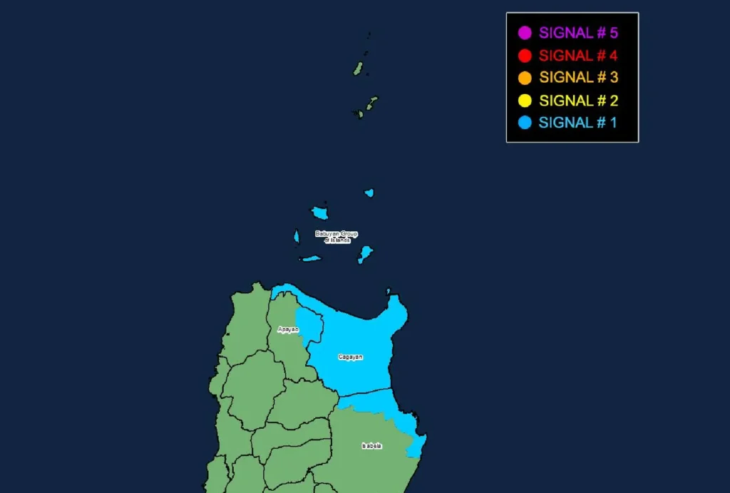
Tropical Cyclone Wind Signal No. 1 has been raised over parts of Luzon, specifically:
- Cagayan, including Babuyan Islands
- Northeastern Isabela (municipalities of Maconacon, San Pablo, Cabagan, Santa Maria, Divilacan, Palanan)
- Eastern Apayao (Flora, Santa Marcela, Luna, Pudtol)
Residents in these areas can expect strong winds ranging from 39 to 61 km/h within the next 36 hours. Minimal to minor impacts on life and property are possible.
The highest possible wind signal for this cyclone could reach Signal No. 4, depending on further developments.
Other Hazards Affecting Land Areas
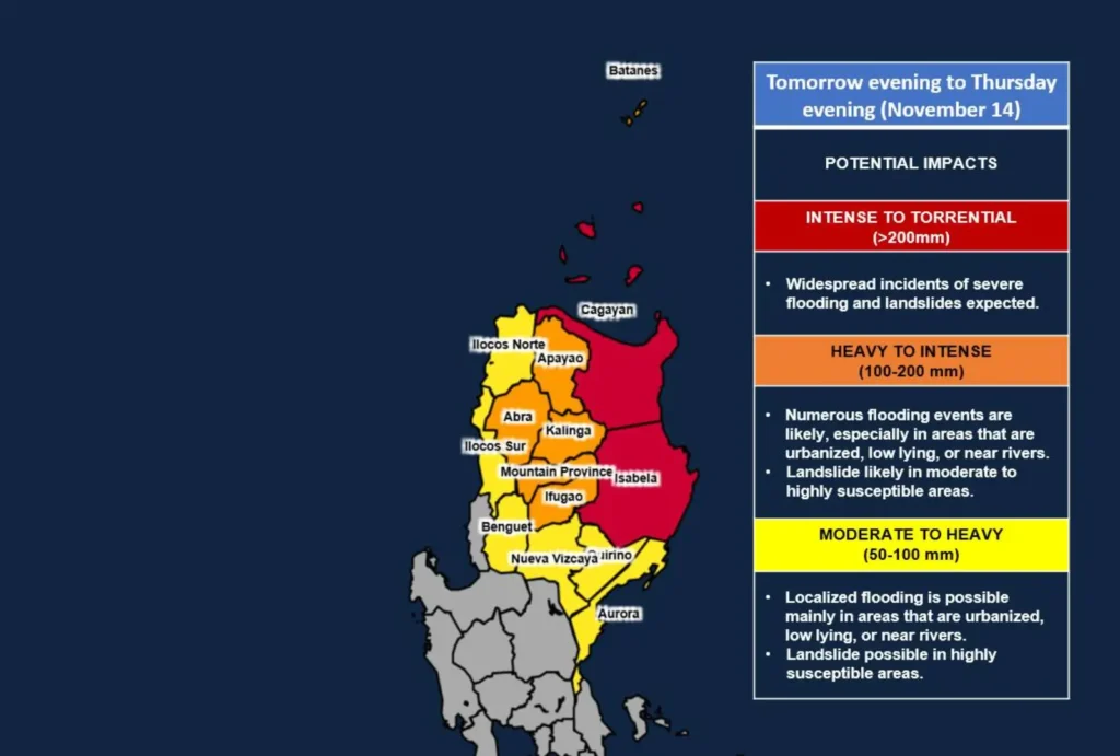
- Heavy Rainfall: Refer to Weather Advisory No. 21 for rainfall projections.
- Severe Winds: Winds will be stronger in coastal and highland areas. Camarines Norte, Camarines Sur, and Catanduanes may experience gusts tomorrow, while strong winds are expected in Eastern Quezon, including Polillo Islands, and Isabela in the coming days.
- Storm Surge Risk: A storm surge with heights of 1.0 to 2.0 meters poses a threat to low-lying coastal areas in Ilocos Norte, Cagayan, Isabela, and Northern Aurora.
Sea Conditions
Mariners should avoid rough seas in the following areas:
- Up to 3.0-meter waves along the northern and eastern seaboards of Catanduanes.
- Up to 2.5-meter waves along the eastern seaboards of Cagayan, Isabela, Aurora, and several provinces in Bicol and Samar.
Small seacraft operators and those with minimal experience are advised to refrain from venturing out to sea.
Track and Intensity Forecast
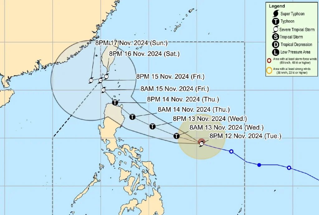
Ofel is projected to continue moving west-northwest and may make landfall along the eastern coast of Cagayan or Isabela on Thursday, 14 November.
It is expected to reach typhoon status by tomorrow, November 13, and may make landfall at peak intensity.
The storm will then head toward the Luzon Strait, slowing and behaving erratically over the weekend.
Authorities emphasize that impacts may be felt even outside the predicted track, and adjustments to the forecast are possible.
Residents in affected areas should stay updated and follow advisories from weather agencies.