
Tropical Storm Paolo continues to move west northwestward over the Philippine Sea and is forecast to make landfall over Isabela or northern Aurora by Friday morning.
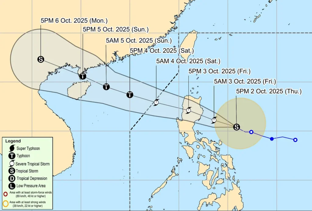
As of 7:00 PM, Paolo was located 370 kilometers east of Baler, Aurora, with maximum sustained winds of 85 km/h and gusts reaching up to 105 km/h, based on data from Baler and Daet Doppler radars.
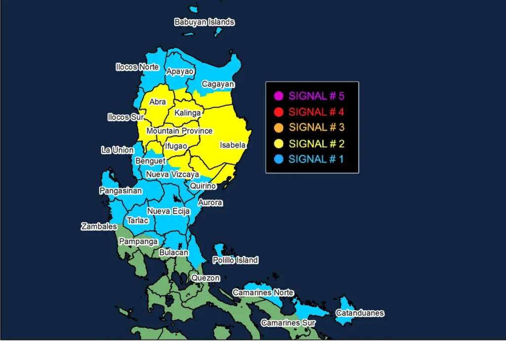
The storm’s wind field has expanded significantly, with strong to gale-force winds extending up to 350 kilometers from its center, prompting PAGASA to raise Tropical Cyclone Wind Signal No. 2 over parts of Cagayan, Isabela, Quirino, Nueva Vizcaya, Apayao, and Ilocos Sur.
Signal No. 1 remains in effect across a wide swath of Northern and Central Luzon, including Ilocos Norte, La Union, Pangasinan, Zambales, Tarlac, Nueva Ecija, Bulacan, Pampanga, Quezon, Camarines Norte, Camarines Sur, and Catanduanes.
Heavy rainfall is expected in affected areas, with localized flooding and landslides possible, especially in upland and coastal communities exposed to enhanced winds.
Storm surge warnings have been issued for low-lying coastal areas in Ilocos Norte, Ilocos Sur, Cagayan, Isabela, Aurora, and Quezon, with peak heights reaching 1.0 to 3.0 meters within 36 hours.
Gale warnings are in effect over the eastern seaboards of Northern and Central Luzon, with sea conditions ranging from rough to very rough, making sea travel hazardous for all types of vessels.
Paolo is expected to intensify further and may reach severe tropical storm category tonight, with a high likelihood of becoming a typhoon once it crosses Luzon and enters the West Philippine Sea.
Forecast models suggest a possible southward shift in Paolo’s track depending on the strength of the high-pressure area north of the system, which could alter its landfall point and impact zone.
The highest wind signal likely to be raised during Paolo’s passage is Signal No. 3, though Signal No. 4 is not ruled out in a worst-case scenario.
PAGASA urges residents and disaster response units to prepare for severe weather, monitor official advisories, and follow evacuation orders in high-risk areas.