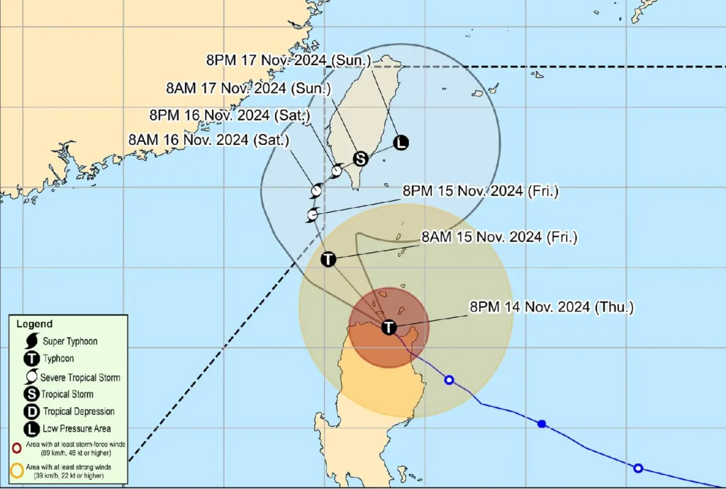
Typhoon OFEL (Usagi) continues to weaken as it passes through the Babuyan Islands, the Philippine Atmospheric, Geophysical and Astronomical Services Administration (PAGASA) reported in its latest bulletin issued at 11:00 PM on November 14.
As of 10:00 PM, the typhoon’s center was located over the coastal waters of Calayan, Cagayan, at 18.7°N, 121.5°E. OFEL packs maximum sustained winds of 130 km/h near the center and gusts of up to 200 km/h, with a central pressure of 970 hPa.
The typhoon is moving northwestward at 15 km/h, and strong to typhoon-force winds extend outwards up to 360 kilometers from its center.
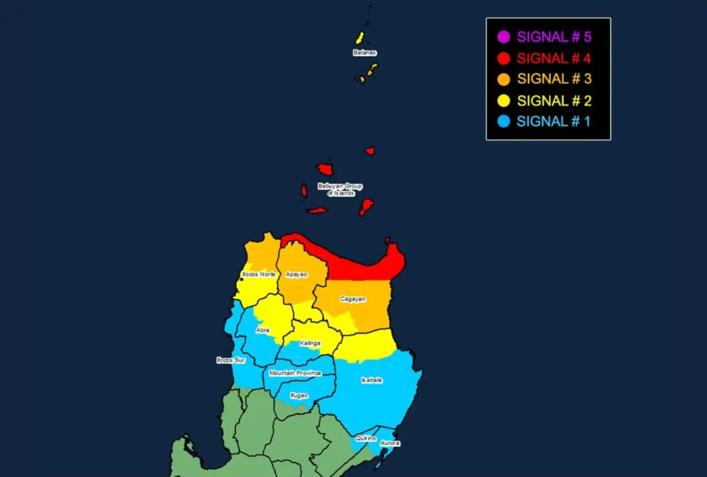
Tropical Cyclone Wind Signals (TCWS) remain in effect:

- TCWS No. 4: Northern Cagayan and Babuyan Islands, with typhoon-force winds expected and significant to severe impacts on life and property.
- TCWS No. 3: Portions of Batanes, Cagayan, Apayao, and Ilocos Norte, where storm-force winds pose moderate to significant threats.
- TCWS No. 2: Areas in Batanes, Cagayan, Isabela, Kalinga, Abra, and Ilocos Norte experiencing gale-force winds and minor to moderate impacts.
- TCWS No. 1: Warnings extend to parts of Isabela, Quirino, Kalinga, Mountain Province, Ifugao, Ilocos Sur, and Aurora, with strong winds anticipated.
PAGASA warns of severe winds in coastal and upland areas, with typhoon-force winds causing potentially life-threatening impacts in regions under Signal No. 4.
Coastal inundation remains a significant threat, with storm surge heights expected to exceed 3 meters in vulnerable areas of Batanes, Ilocos Norte, Cagayan, and northern Aurora.
A Gale Warning has been issued for northern and eastern seaboards, with waves reaching up to 8 meters.
Sea travel is considered hazardous, and mariners are advised to stay in port until conditions improve.

Typhoon OFEL is forecast to continue its northwestward trajectory, potentially making landfall near Babuyan Islands before exiting the Philippine Area of Responsibility (PAR) this weekend.
OFEL is expected to gradually weaken as it encounters less favorable conditions near Taiwan.
Communities in the affected areas are urged to stay alert, follow updates from PAGASA, and take necessary precautions to safeguard life and property.
