Issued at 11:00 PM, November 4, 2024 — Severe Tropical Storm Marce (international name Yinxing) has intensified further as it moves northwestward over the Philippine Sea, bringing potential heavy rains, severe winds, and dangerous sea conditions, particularly over Northern Luzon and nearby regions.
Current Position and Intensity
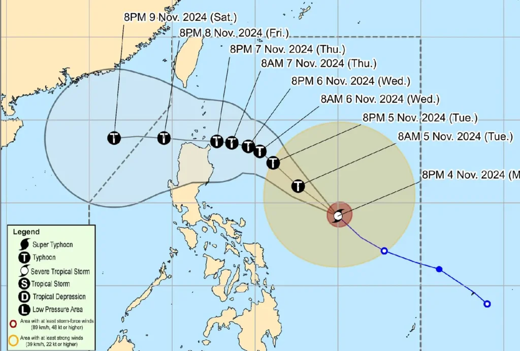
As of 4:00 PM, Marce was located approximately 715 km east of Daet, Camarines Norte, moving northwest at 35 km/h.
The storm now packs maximum sustained winds of 100 km/h near its center, gusts reaching up to 125 km/h, and a central pressure of 985 hPa.
Winds from Marce extend up to 600 km from the storm’s center, posing a broad threat across affected areas.
Tropical Cyclone Wind Signal in Effect

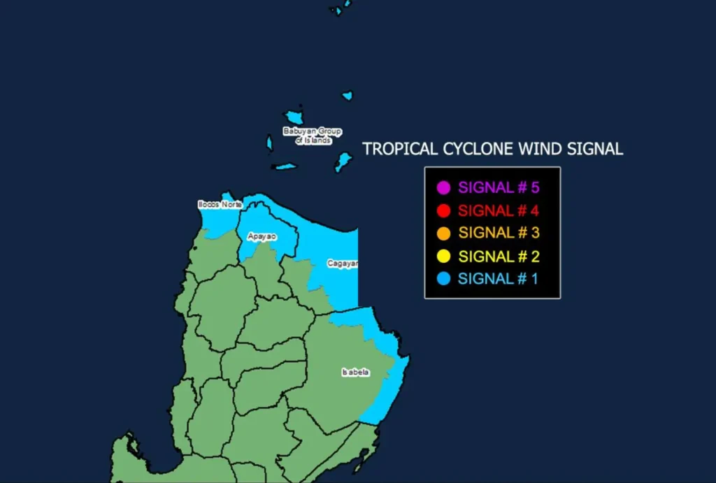
Tropical Cyclone Wind Signal (TCWS) No. 1 has been raised over:
- Luzon: Batanes, Babuyan Islands, eastern Isabela, northern and eastern Cagayan, northern Apayao, and northern Ilocos Norte.
In these areas, winds of 39-61 km/h are expected, presenting minimal to minor risks to life and property.
Signal No. 4 remains the highest potential wind warning for Marce, depending on its intensification as it nears Northern Luzon.
Forecast Track and Intensification

Marce is forecast to continue its northwestward path through tomorrow before slowing and veering westward over the Philippine Sea, east of Northern Luzon.
Landfall is anticipated in the Babuyan Islands or northern Cagayan late Thursday or early Friday, November 7-8.
The system may strengthen into a typhoon by Tuesday evening or Wednesday morning.
Other Weather Impacts
- Rainfall: Heavy rains are expected over Northern Luzon and the eastern sections of Luzon. A Weather Advisory will be issued as necessary.
- Winds: Enhanced northeasterly winds will bring strong to gale-force gusts, especially in exposed coastal and mountainous areas across Ilocos Sur, Aurora, Quezon, and parts of Camarines Norte.
Coastal and Sea Conditions
A Gale Warning is likely tomorrow over Northern Luzon’s seaboards. Mariners in affected areas are urged to stay ashore as sea conditions will remain hazardous.
- Rough seas (up to 3.5 meters): Batanes
- Rough seas (up to 3.0 meters): Babuyan Islands, Ilocos Norte, Ilocos Sur, Isabela, northern Aurora, and Cagayan’s eastern seaboard
Public Advisory
Residents in affected areas are advised to prepare for evacuation and follow local safety instructions to protect lives and property.
Those in coastal and low-lying regions should stay vigilant, and small watercraft operators are strongly cautioned against sailing.
