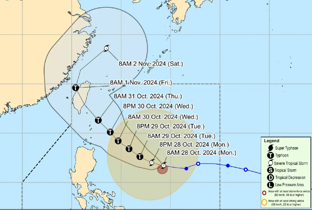
Severe Tropical Storm Leon, internationally known as Kong-Rey, has intensified as it moves westward over the Philippine Sea.
As of 10:00 AM today, Leon was located 735 km east of Casiguran, Aurora, with maximum sustained winds of 95 km/h and gusts reaching 115 km/h.
The storm is moving at 20 km/h and is expected to bring strong winds and heavy rainfall to parts of Luzon in the coming days.
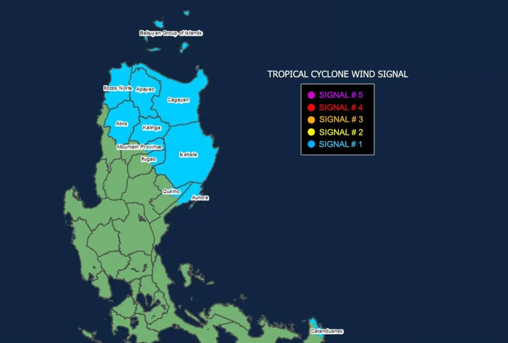
Areas Under Tropical Cyclone Wind Signal No. 1

The following areas are currently under Tropical Cyclone Wind Signal No. 1 due to the anticipated strong winds: Batanes, Cagayan (including Babuyan Islands), Isabela, Ilocos Norte, and portions of Abra, Apayao, Kalinga, Mountain Province, Ifugao, Quirino, and Aurora.
Winds in these regions are expected to range between 39-61 km/h, posing minimal to minor threats to life and property.
Rough Seas and Gale Warnings
A Gale Warning has been raised over the northern and eastern seaboards of Northern Luzon, with sea waves reaching up to 5.5 meters around Batanes and Babuyan Islands.
Mariners are advised against sea travel in these areas due to hazardous conditions, and those on small watercraft are urged to remain in port.
Track and Forecast

Leon is forecast to intensify further, potentially reaching typhoon category within the next 24 hours. A westward-northwestward movement is expected until tomorrow, followed by a turn northwestward.
Leon is projected to make landfall along Taiwan’s eastern coast by Thursday night or Friday morning.
Should Leon continue its westward shift, Batanes may experience a close approach or even landfall.
The public, especially in Northern Luzon, is advised to monitor further updates and heed warnings, particularly regarding sea travel and wind advisories, as Leon continues to strengthen.
