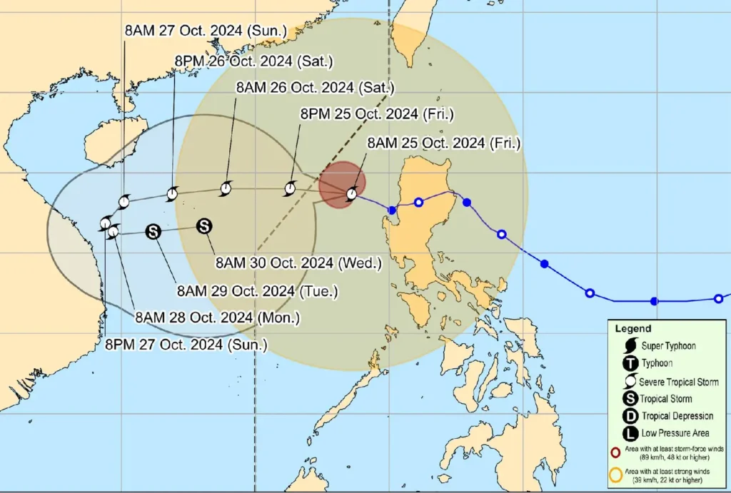
Severe Tropical Storm Kristine (#KristinePH), also known internationally as TRAMI, is about to exit the Philippine Area of Responsibility (PAR) this afternoon or evening.
As of 10:00 AM today, the center of the storm was located 255 km west-northwest of Bacnotan, La Union, or 255 km west-southwest of Sinait, Ilocos Sur.
The storm is packing maximum sustained winds of 95 km/h, with gusts reaching up to 115 km/h. It is moving west-northwestward at a speed of 15 km/h.
Tropical Cyclone Wind Signals (TCWS) Raised

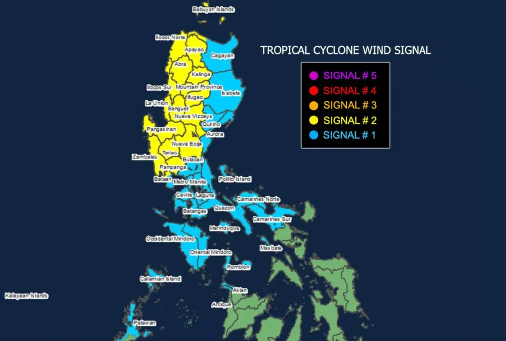
- TCWS No. 2 remains in effect over parts of Northern and Central Luzon, including Ilocos Sur, Ilocos Norte, Pangasinan, and Zambales, with gale-force winds between 62-88 km/h expected in the next 24 hours. Residents in these areas may experience minor to moderate impacts on life and property.
- TCWS No. 1 has been raised over several other provinces, including Metro Manila, Bataan, Cavite, Batangas, and parts of Visayas, as winds of 39-61 km/h are anticipated within 36 hours.
Coastal Hazards and Sea Conditions
There is a moderate risk of storm surges of 1.0 to 2.0 meters over low-lying coastal areas in Ilocos Sur, La Union, Pangasinan, and Zambales within the next 48 hours.
Mariners are warned of very rough seas, particularly in the western seaboards of Pangasinan, Zambales, Bataan, and parts of Palawan and Visayas, where waves may reach up to 6 meters.
Track and Intensity Outlook

Kristine is forecast to continue moving westward over the West Philippine Sea and may intensify slightly after exiting PAR. However, a counterclockwise loop is expected on Sunday and Monday, possibly pulling the storm back towards the PAR region early next week.
The public is advised to stay alert for further updates and heed evacuation orders from local authorities as the storm exits PAR. Coastal communities and fishermen are strongly urged to avoid sea travel as conditions remain perilous.
