
As of 10:00 AM today, Tropical Storm Kristine continues to maintain its strength over the Philippine Sea, positioned 335 km east of Virac, Catanduanes.
With maximum sustained winds of 65 km/h near the center, gustiness up to 80 km/h, and central pressure at 994 hPa, Kristine is moving west-northwestward at 10 km/h.
Wind Signals in Effect
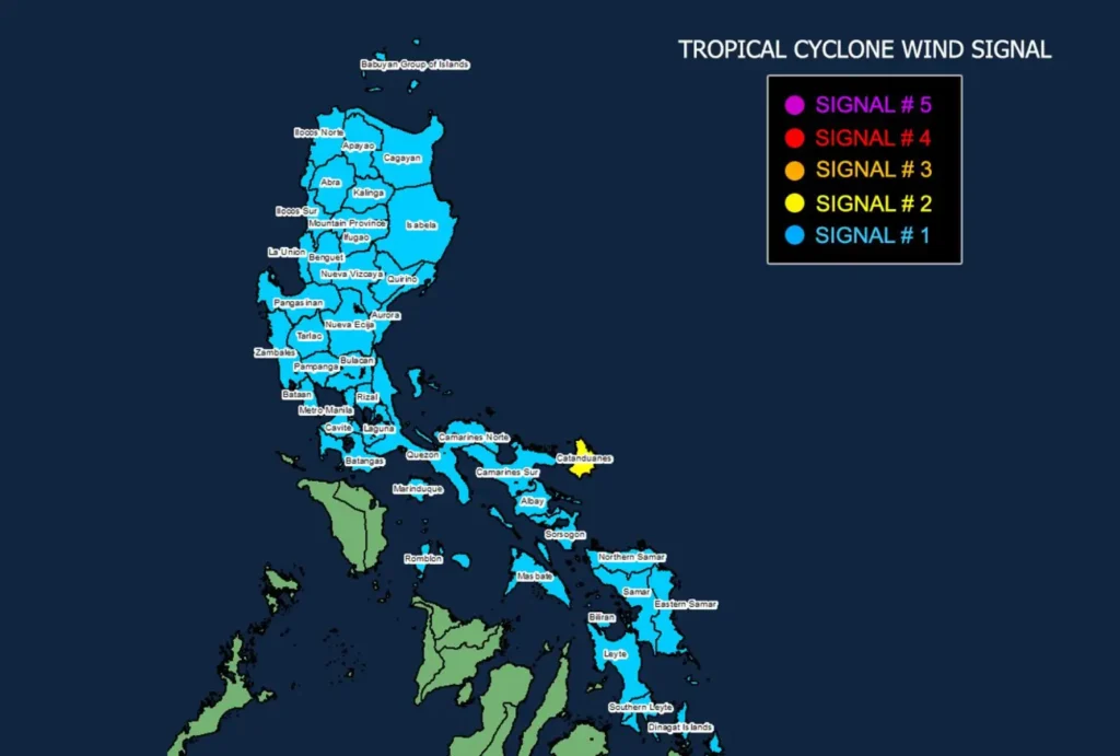
Tropical Cyclone Wind Signal (TCWS) No. 2 has been raised over Catanduanes in Luzon, with a wind threat of strong to gale-force winds expected within the next 24 hours.
Wind speeds are forecast to range from 62 to 88 km/h, posing minor to moderate threats to life and property.
TCWS No. 1 is hoisted over several provinces in Luzon, Visayas, and Mindanao. Affected areas include:
- Luzon: Ilocos Norte, Ilocos Sur, La Union, Pangasinan, and others.
- Visayas: Eastern Samar, Northern Samar, Leyte, among others.
- Mindanao: Dinagat Islands, Surigao del Norte including Siargao, Bucas Grande.
Winds ranging from 39 to 61 km/h are expected in these areas within the next 36 hours, with minimal to minor impacts on life and property.
Other Weather Hazards

- Heavy Rainfall: Heavy rainfall warnings have been issued for certain areas. Residents are advised to monitor the latest weather advisories for updates.
- Coastal Inundation: There is a moderate to high risk of life-threatening storm surge over low-lying coastal areas, especially in Catanduanes, Camarines Sur, Albay, Aurora, Isabela, and Cagayan.
- Gale Warnings: Gale warnings are in effect across the eastern seaboard of Luzon, Southern Luzon, and the eastern Visayas. Sea conditions remain dangerous, with waves reaching up to 7.0 meters in some areas.
Track and Intensity Outlook
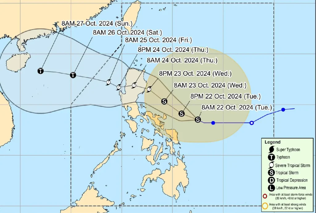
Tropical Storm Kristine is forecast to move generally northwestward, potentially making landfall over Isabela or northern Aurora by tomorrow evening (October 23) or early Thursday morning.
It is expected to intensify into a severe tropical storm before landfall, though slight weakening may occur as it crosses Northern Luzon.
Kristine may become a typhoon once it enters the West Philippine Sea and exit the Philippine Area of Responsibility by Friday, October 25.
Authorities are urging the public and disaster preparedness offices to take necessary precautions. Those in high-risk areas are advised to follow evacuation orders and safety protocols as directed by local officials.
Mariners are advised against sea travel as conditions remain hazardous.