
Typhoon Julian (International name: Krathon) has re-entered the Philippine Area of Responsibility (PAR) and is on track to make landfall over Southern Taiwan this afternoon.
The storm is currently located 245 km northwest of Itbayat, Batanes, with maximum sustained winds of 120 km/h and gusts reaching up to 165 km/h.
Current Status:
- Location of Eye (as of 4:00 AM): 245 km Northwest of Itbayat, Batanes (22.4°N, 120.2°E)
- Wind Speed: 120 km/h sustained, gustiness up to 165 km/h
- Pressure: 975 hPa
- Movement: Slowly moving east-northeastward
- Wind Extent: Strong to typhoon-force winds extend outward up to 270 km from the center
Tropical Cyclone Wind Signals (TCWS)
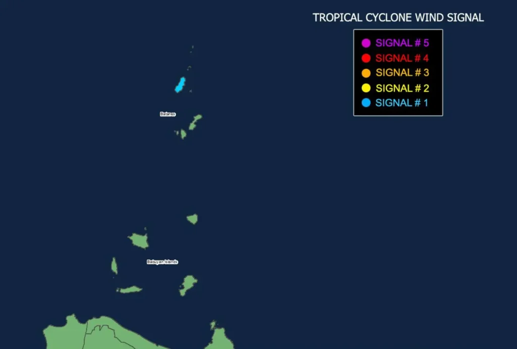
- TCWS No. 1 is raised over Batanes (Itbayat), signaling a threat of strong winds. Affected areas should prepare for winds ranging from 39 to 61 km/h, with minimal to minor impacts on life and property.
Sea Conditions and Gale Warnings
A Gale Warning remains in effect for the northern seaboard of Northern Luzon, with sea waves reaching up to 4.5 meters in height near Batanes.
Mariners are strongly advised to avoid sea travel, as conditions remain dangerous for small vessels and motorbancas.
Moderate to rough seas are also expected over the seaboards of Babuyan Islands, Ilocos Norte, Zambales, and other northern regions.
Forecast Track and Intensity
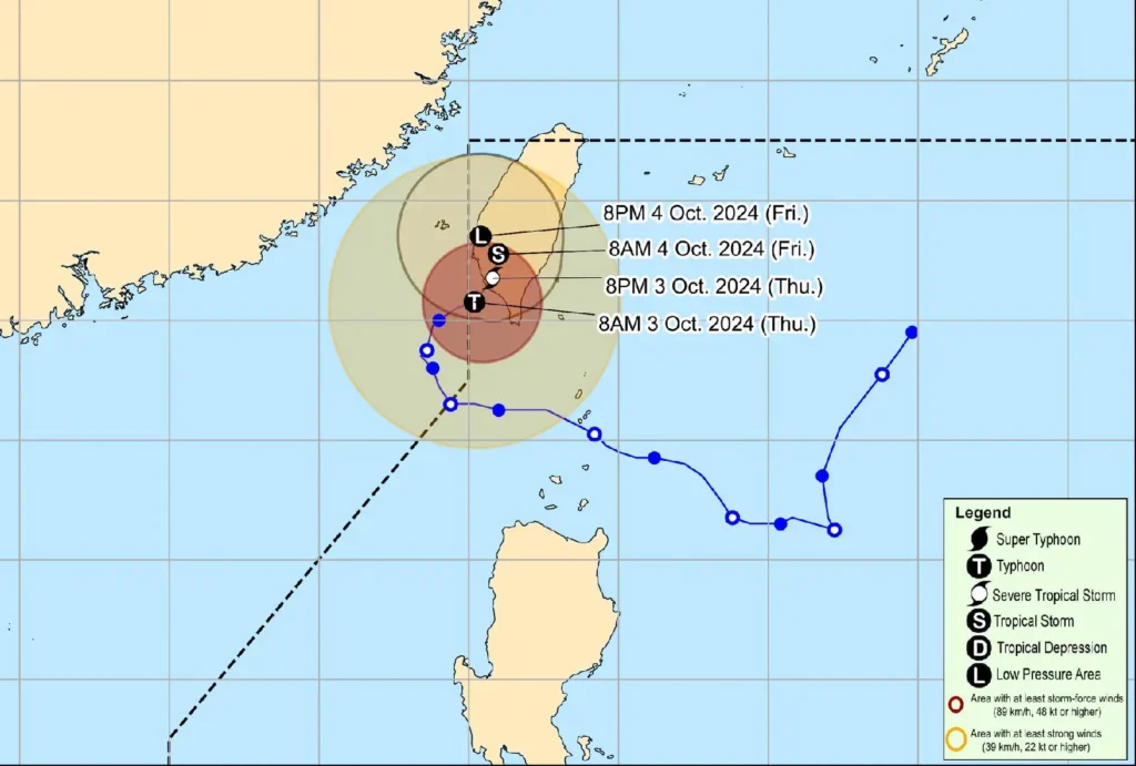
Typhoon Julian is expected to make landfall over southwestern Taiwan later today, where it will weaken rapidly due to land interaction and cooler ocean temperatures in the area.
It is forecast to become a remnant low by October 4.
Though Typhoon Julian has re-entered PAR, it is not expected to directly impact the Philippines, except for Batanes, which may experience strong winds and rough seas due to its proximity to Taiwan.
Public Safety Advisory
Residents in Batanes and nearby areas are urged to monitor weather updates and follow any advisories from local disaster management offices.
Mariners, especially those operating small boats, are advised to remain in port or seek shelter until sea conditions improve. Further, the public should heed evacuation orders and prepare for potential hazards.