
Typhoon Paolo (international name: Matmo) made landfall over Dinapigue, Isabela on the morning of October 3, 2025, prompting the state weather bureau to raise Tropical Cyclone Wind Signal (TCWS) No. 4 across parts of Northern Luzon.
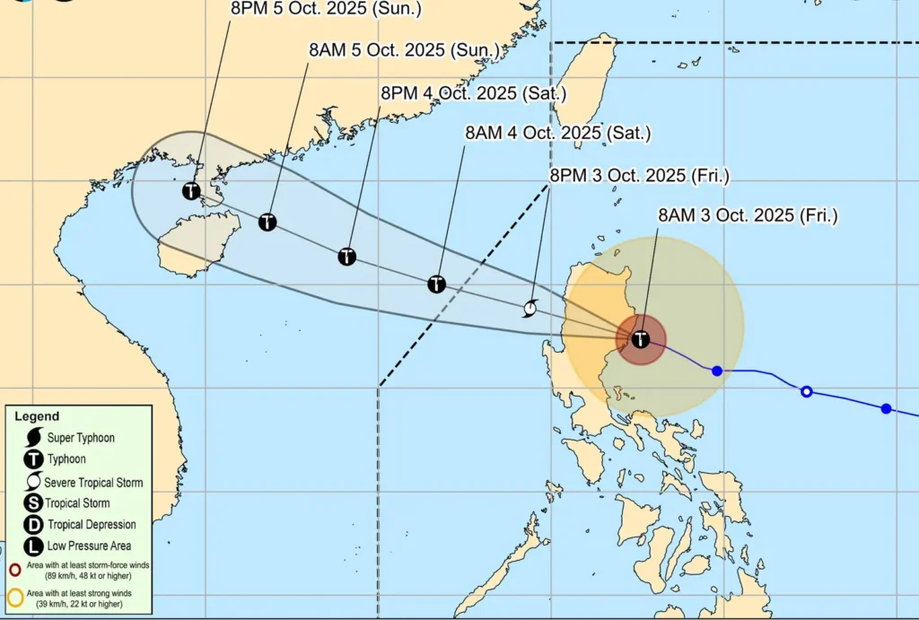
According to PAGASA’s 11:00 AM bulletin, Paolo intensified into a typhoon just before landfall, packing maximum sustained winds of 130 km/h and gusts reaching up to 215 km/h.
As of 10:00 AM, the typhoon’s eye was located near San Guillermo, Isabela, moving west-northwestward at 25 km/h.
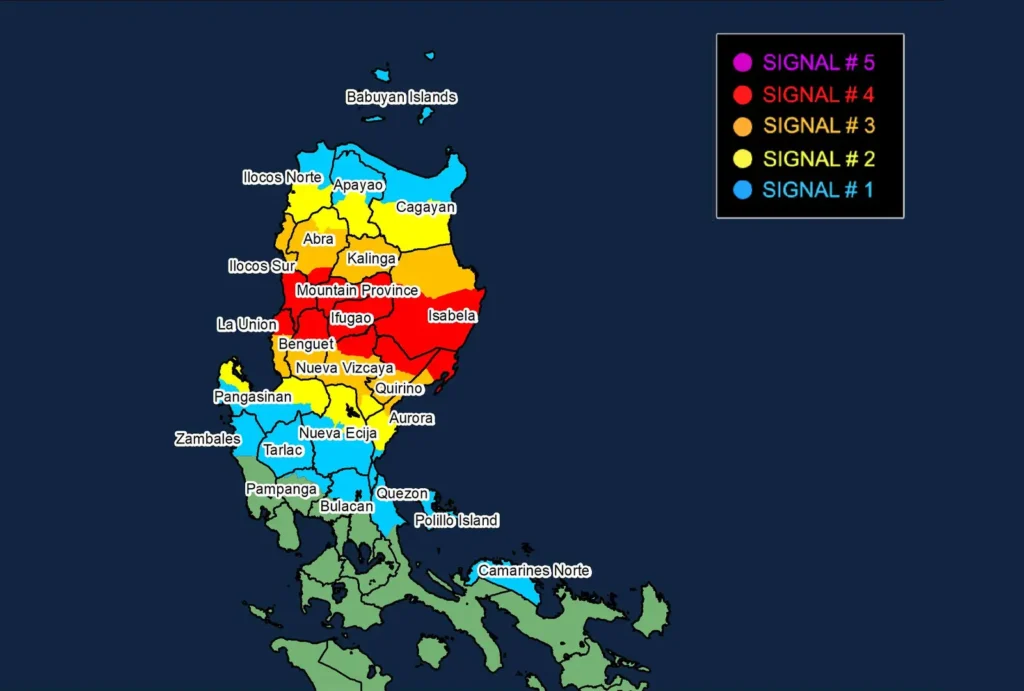
TCWS No. 4 is now in effect for southern Isabela, northern Quirino and Nueva Vizcaya, Mountain Province, Ifugao, and portions of Benguet, Abra, Ilocos Sur, and La Union.
PAGASA warned of severe impacts from typhoon-force winds, including widespread structural damage and uprooted vegetation.
TCWS No. 3 remains active for the rest of Isabela, Quirino, Benguet, Ilocos Sur, La Union, and parts of Aurora, Nueva Vizcaya, Kalinga, and Abra.
TCWS No. 2 and No. 1 extend coverage from Cagayan in the north to Pangasinan, Tarlac, and northern Quezon in the south.
A high-risk Storm Surge Warning has been issued, with wave heights expected to reach up to 7.0 meters along Isabela’s coast.
Broader warnings are in place for surges exceeding 3.0 meters in low-lying coastal areas of Zambales, Bataan, Metro Manila, CALABARZON, Mindoro, Palawan, Bicol Region, and parts of the Visayas.
The typhoon is currently traversing Northern Luzon’s mountainous terrain and is forecast to re-emerge over the West Philippine Sea later today.
While slight weakening is possible during land interaction, Paolo is expected to remain a typhoon and may re-intensify before exiting the Philippine Area of Responsibility (PAR) tomorrow morning.
Authorities urge residents under Signal No. 4 and along the storm’s path to take extreme precautions and heed all directives from local disaster officials.
Heavy rainfall continues to threaten widespread flooding and landslides across affected regions.