- Advertisement -
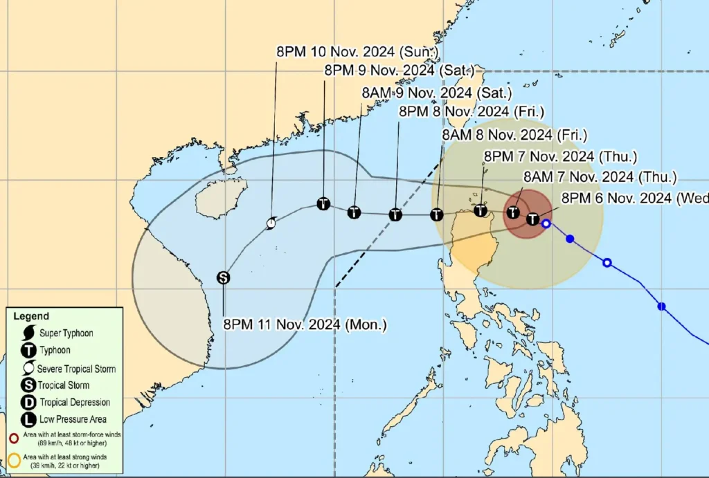
Typhoon Marce (YINXING) continues to strengthen, now advancing west-northwestward toward the northern mainland Cagayan and Babuyan Islands area.
At 10:00 PM, Marce was located approximately 240 kilometers east of Aparri, Cagayan. Currently, it packs sustained winds of 155 km/h near the center, with gusts reaching 190 km/h and a central pressure of 955 hPa.
- Advertisement -
Current Movement and Wind Signals
- Direction: West-northwest at 10 km/h
- Typhoon Winds Extent: Reaches up to 560 km from the center
Tropical Cyclone Wind Signals in Effect:

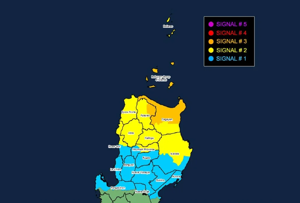
- Signal No. 3: Northern and central Cagayan (including Babuyan Islands) and eastern Apayao face storm-force winds, with speeds between 89 and 117 km/h. This poses moderate to significant threats to life and property.
- Signal No. 2: Batanes, parts of Cagayan, northern Isabela, and areas in Apayao, Abra, Kalinga, Mountain Province, Ilocos Norte, and northern Ilocos Sur experience gale-force winds with a minor to moderate threat.
- Signal No. 1: Strong winds expected in portions of Ilocos Sur, La Union, northern Pangasinan, Mountain Province, Ifugao, Benguet, Isabela, Quirino, Nueva Vizcaya, and Aurora.
Coastal and Sea Condition Warnings
- High Storm Surge Risk: Life-threatening surges over 3.0 meters expected along low-lying coasts of Batanes, Cagayan, Babuyan Islands, Isabela, and portions of Ilocos Region.
- Rough to Very Rough Seas: Waves up to 12 meters may impact the northern seaboards of Cagayan, Ilocos Norte, Batanes, and Babuyan Islands, making sea travel extremely risky.
Track and Intensity Outlook

Typhoon Marce is projected to continue its approach towards Cagayan and Babuyan Islands, making landfall or closely passing by these areas tomorrow afternoon through Friday morning.
While the typhoon may experience slight weakening due to interaction with Luzon’s terrain, it is expected to remain a powerful typhoon until it exits the Philippine Area of Responsibility on Friday evening.
- Advertisement -
