
Typhoon Julian (internationally named “Krathon”) has weakened but remains a powerful system as it moves slowly northwestward, away from the Philippines.
According to the latest bulletin from the Philippine Atmospheric, Geophysical and Astronomical Services Administration (PAGASA), the center of Typhoon Julian was located 280 km west-northwest of Itbayat, Batanes, just outside the Philippine Area of Responsibility (PAR).
Typhoon Strength and Movement
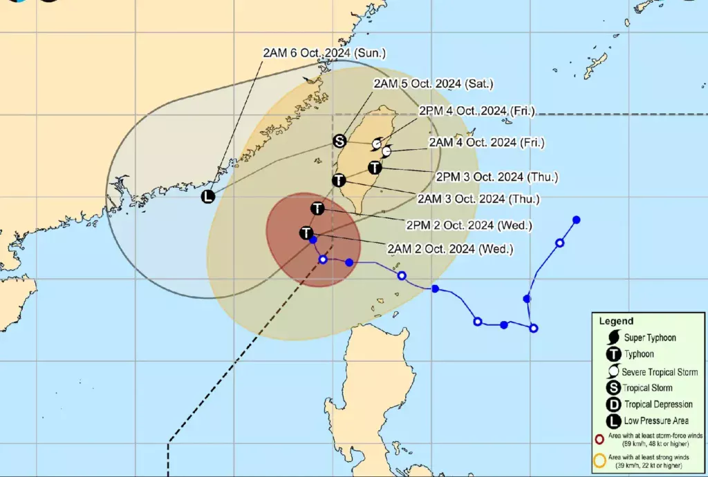
As of 4:00 AM, Typhoon Julian is packing maximum sustained winds of 165 km/h near the center, with gusts reaching up to 205 km/h. The central pressure is measured at 945 hPa.
Although it has weakened, Julian’s strong winds extend up to 650 km from the eye, posing risks to areas in Northern Luzon.
The typhoon is currently moving slowly towards the northwest and is forecasted to make a northeastward turn towards Taiwan’s southwestern coast by tonight or early tomorrow.
After landfall, Julian is expected to weaken further and may become a remnant low by the weekend.
Tropical Cyclone Wind Signals
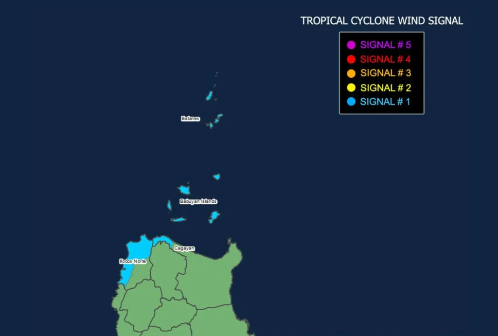
Tropical Cyclone Wind Signal (TCWS) No. 1 is currently raised in several parts of Luzon, specifically in Batanes, Babuyan Islands, and portions of Ilocos Norte and mainland Cagayan. Areas under TCWS No. 1 can expect wind speeds between 39 to 61 km/h, which may cause minimal to minor damage. Winds will be stronger in coastal and mountainous regions, so residents are advised to take precautions.
Coastal Hazards and Sea Conditions
A Gale Warning is in effect for the northern seaboard of Northern Luzon, including Batanes and Babuyan Islands.
Extremely rough seas with waves up to 5.0 meters are expected in these areas, making sea travel hazardous. Mariners, especially those operating small boats, are advised to stay in port and avoid venturing out to sea.
Rough sea conditions are also expected in other parts of Northern and Central Luzon, with waves ranging from 2.5 to 4.5 meters. Small seacrafts are advised to seek shelter and avoid these waters.
Rainfall and Safety Measures
Although the typhoon is outside PAR, it may still enhance the southwest monsoon, bringing scattered rains over parts of Northern Luzon.
Residents in affected areas should stay updated through PAGASA’s rainfall advisories and warnings.
Local disaster risk reduction offices and residents, particularly in areas susceptible to strong winds and rough seas, are urged to take all necessary precautions and follow local government evacuation orders.
Continuous monitoring of updates is recommended as changes in the typhoon’s track are still possible.