


Typhoon Julian, locally known as KRATHON, continues to maintain its strength as it slowly moves north-northeastward, with the center of the storm currently located approximately 265 kilometers west-northwest of Itbayat, Batanes.
The typhoon is expected to have a significant impact in the coming hours as it approaches Taiwan.
Current Conditions
As of the latest report, Typhoon Julian exhibits maximum sustained winds of 165 km/h near its center, with gusts reaching up to 205 km/h.
The central pressure of the storm is measured at 945 hPa, and the extent of its tropical cyclone winds spans up to 440 km from the center.
The public is urged to remain vigilant as the storm is forecasted to make landfall on Taiwan tonight or early tomorrow morning (October 3).
Tropical Cyclone Wind Signals
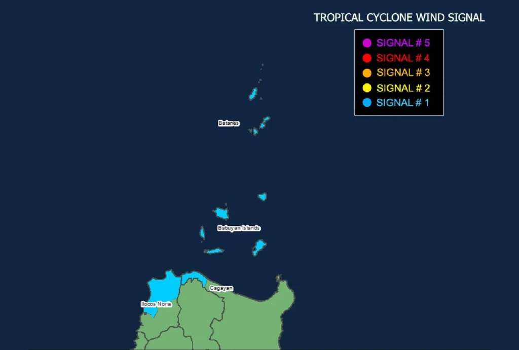
The Philippine Atmospheric, Geophysical and Astronomical Services Administration (PAGASA) has issued Tropical Cyclone Wind Signal No. 1 for the following areas:
- Luzon: Batanes, Babuyan Islands, and the northern and western portions of Ilocos Norte, including Pasuquin, Sarrat, Bangui, Vintar, Burgos, Pagudpud, Bacarra, Adams, San Nicolas, Dumalneg, Laoag City, and the northwestern portion of mainland Cagayan (Santa Praxedes, Sanchez-Mira, Claveria).
Wind Threat: Residents can expect strong winds ranging from 39 to 61 km/h, posing minimal to minor threats to life and property. Wind conditions may be enhanced in coastal and mountainous regions.
Heavy Rainfall Outlook
In addition to strong winds, heavy rainfall is expected as Typhoon Julian approaches. Local officials are encouraged to monitor updates and advisories regarding severe weather, including potential flash flooding and landslides in vulnerable areas.
Coastal Hazards
A Gale Warning has been issued over the northern seaboard of Northern Luzon. Mariners are advised of very rough seas, with wave heights expected to reach up to 5.0 meters near Batanes and 4.5 meters around the Babuyan Islands and northern Ilocos Norte.
Sea travel is deemed risky, especially for small vessels and motorbancas.
Track and Intensity Outlook
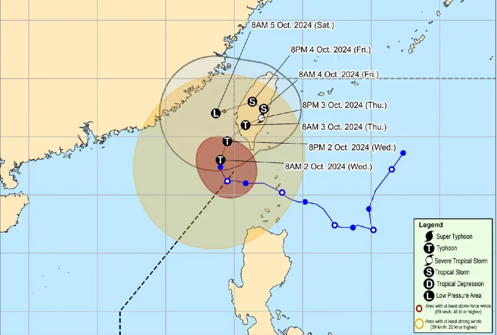
Forecast models indicate that Typhoon Julian is expected to turn northeast toward Taiwan, where it will likely make landfall tonight.
Post-landfall, the storm is predicted to weaken significantly due to land friction and cooler ocean waters. By the weekend, Julian may degrade into a remnant low.
Safety Measures In light of these developments, the public, especially those in highly susceptible areas, is urged to take necessary precautions and heed any evacuation orders from local authorities. Continuous monitoring of local weather updates is essential for ensuring safety.
The next tropical cyclone bulletin is scheduled for release at 5:00 PM today. Stay tuned for further updates.