September 28, 2024, 11:00 AM — Tropical Storm Julian (international name: JulianPH) has intensified, bringing strong winds and heavy rains to parts of Northern Luzon, according to the Philippine Atmospheric, Geophysical, and Astronomical Services Administration (PAGASA).
As of 10:00 AM today, the center of Tropical Storm Julian was located 465 kilometers east of Aparri, Cagayan (18.8°N, 126.0°E). With maximum sustained winds of 65 km/h and gusts reaching up to 80 km/h, the storm is moving slowly towards the south-southeast.
Tropical cyclone winds are extending outwards up to 380 kilometers from the center, affecting a large area.
Wind Signals Raised

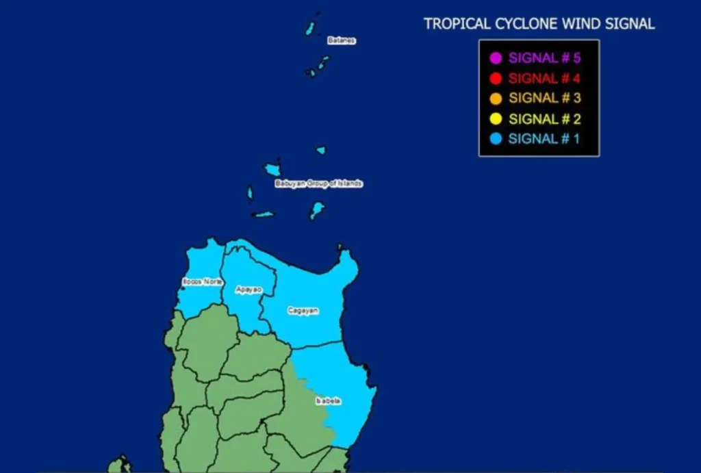
PAGASA has raised Tropical Cyclone Wind Signal (TCWS) No. 1 over the following areas:
- Luzon: Batanes, Cagayan (including Babuyan Islands), Apayao, Ilocos Norte, and parts of Isabela (San Pablo, Divilacan, Maconacon, Palanan, Cabagan, Santa Maria, Tumauini, Ilagan City, San Mariano, Santo Tomas, Delfin Albano, Dinapigue).
Under this wind signal, winds ranging from 39 to 61 km/h (Beaufort 6 to 7) are expected within the next 36 hours. Potential impacts on life and property are expected to be minimal to minor, but residents are still urged to stay alert.
Rainfall and Flooding Risks

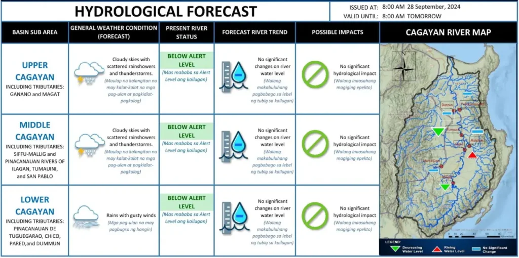
While the storm’s winds are moderate, residents in the affected areas should prepare for possible heavy rainfall. PAGASA advises the public to monitor Weather Advisory No. 6 for further updates on rainfall outlook and to follow any evacuation or safety instructions from local authorities. Rain is expected to intensify particularly in coastal and mountainous areas as the storm approaches.
Hazardous Sea Conditions
Very rough seas are expected along the coasts of Batanes and Babuyan Islands, with waves reaching up to 5.0 meters. Small seacrafts and motorbancas are advised not to venture out due to the risky sea conditions.
Mariners of larger vessels should ensure proper precautions and experience in navigating these waters. Gale warnings may be issued later today.
Meanwhile, rough sea conditions will prevail over the northern seaboard of mainland Cagayan and Ilocos Norte, with waves reaching up to 4.0 meters. Smaller coastal areas, including parts of Isabela, will experience slightly lower but still dangerous wave heights of up to 3.5 meters.
Mariners are urged to stay in port or avoid the sea until conditions improve.
Track and Intensification

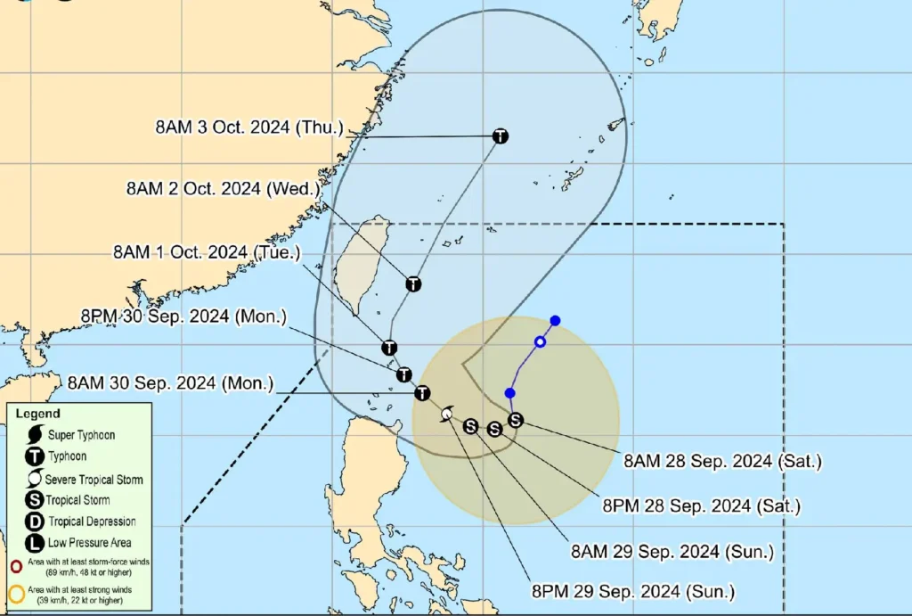
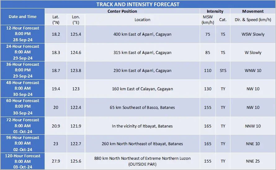
Tropical Storm Julian is forecast to move west-southwestward today before changing course to the northwest tomorrow, eventually heading towards the Batanes-Babuyan Islands area by Monday.
PAGASA warns that the storm may intensify into a typhoon by then, with the possibility of rapid intensification into a super typhoon not ruled out.
Although landfall is not yet certain, the storm is expected to approach Batanes and Babuyan Islands at peak intensity.
The public is advised to stay vigilant and prepare for the storm’s effects, especially those living in flood- or landslide-prone areas.

Next Update
PAGASA will issue its next bulletin at 5:00 PM today. Local disaster management offices are advised to take all necessary measures to safeguard life and property.
For more updates on the situation, stay tuned to PAGASA’s advisories and keep track of local weather forecasts.
