- Advertisement -
The Low Pressure Area outside the Philippine Area of Responsibility (PAR) has intensified into a Tropical Depression as it passed near Guam.
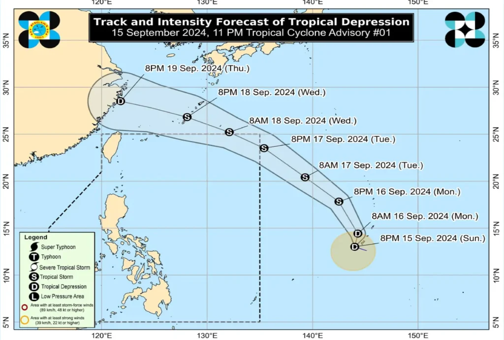
As of 10:00 PM, the center of the Tropical Depression was estimated to be 2,165 km east of Southeastern Luzon (13.2°N, 144.1°E). The depression has maximum sustained winds of 45 km/h near its center, gustiness of up to 55 km/h, and a central pressure of 1002 hPa. It is moving west-northwestward at a speed of 20 km/h, with strong winds extending up to 280 km from its center.
- Advertisement -
Track and Intensity Outlook:

- The Tropical Depression is expected to move east-northeastward over the next 12 hours before turning north-northwestward by tomorrow evening (September 16) until Tuesday evening (September 17).
- The system is forecast to enter the Philippine Area of Responsibility (PAR) by Tuesday evening and may exit by Wednesday morning (September 18). However, changes in the timing of its entry and exit are possible due to the erratic nature of the weather disturbance over the next 12 hours.
- The Tropical Depression is forecast to intensify into a Tropical Storm by tomorrow afternoon or evening. Further intensification cannot be ruled out as the system remains over the Pacific Ocean.
- Current projections show that the Tropical Depression will not directly affect any part of the Philippines during the forecast period.
The public, along with disaster risk reduction and management offices, are advised to stay updated on developments regarding this tropical cyclone.
- Advertisement -
