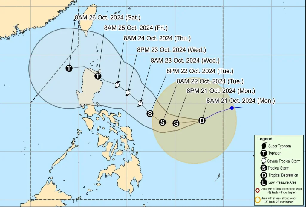
As of 11:00 AM on October 21, 2024, Tropical Depression Kristine continues to strengthen as it moves west southwestward over the Philippine Sea, with maximum sustained winds of 55 km/h and gusts reaching up to 70 km/h.
The center of Tropical Depression Kristine was located 870 km east of Eastern Visayas, moving at a speed of 30 km/h. The system brings strong winds that extend up to 550 km from its center.

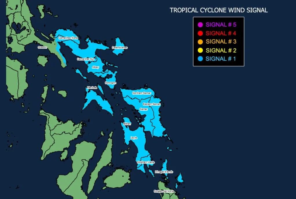
Tropical Cyclone Wind Signal (TCWS) No. 1 has been raised over several parts of Luzon, Visayas, and Mindanao, warning residents of potential impacts from strong winds.
These areas include Catanduanes, Masbate, Leyte, and Dinagat Islands, among others.
Winds in these areas are expected to range between 39 to 61 km/h, posing minimal to minor threats to life and property.
The public is advised to prepare for possible disruptions, particularly in coastal and upland areas.
Kristine is expected to intensify into a tropical storm within the next 12 hours, with further intensification likely as it remains over the Philippine Sea.
It may reach severe tropical storm status by October 23 and possibly become a typhoon by October 24 or 25 before making landfall over Northern Luzon.

The wind flow around Kristine, coupled with the Northeasterly Windflow, will also bring strong to gale-force gusts over areas such as Batanes, Palawan, and Northern Mindanao today, with more regions affected in the coming days.
Coastal waters across various regions, including Isabela, Catanduanes, and Northern Samar, will experience moderate to rough seas with waves reaching up to 4.5 meters.
Mariners, particularly those operating small vessels, are strongly advised against venturing out to sea under these conditions.
Residents in areas highly susceptible to heavy rainfall, flash floods, and landslides are urged to take necessary precautions and follow evacuation orders from local authorities.
The public is advised to monitor updates from PAGASA for any changes in Kristine’s track and intensity, as well as further weather advisories specific to their area.
