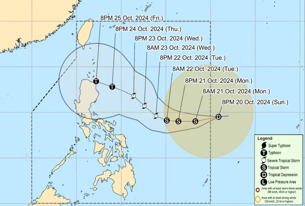
Tropical Depression Kristine has entered the Philippine Area of Responsibility (PAR) as of 4:00 AM today, according to the latest bulletin from PAGASA. Located 1,050 km east of Southeastern Luzon, Kristine is moving west-southwestward at 30 km/h, with maximum sustained winds of 55 km/h and gustiness of up to 70 km/h.
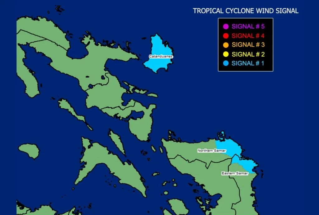
Tropical Cyclone Wind Signal No. 1 has been raised over Catanduanes and parts of Northern Samar and Eastern Samar in the Visayas, signaling the possibility of strong winds over the next 36 hours.
Winds in these areas are expected to range between 39 to 61 km/h, posing minimal to minor threats to life and property.

Coastal Hazards and Marine Warnings
Moderate to rough seas with waves up to 4.0 meters are expected along the seaboards of Isabela, Northern Aurora, Catanduanes, Northern Samar, and Mainland Cagayan. Mariners of small vessels are advised to stay ashore due to hazardous conditions.
Waves of up to 3.5 meters are also forecast in Batanes, Cagayan, Aurora, and Quezon, with up to 3.0-meter waves expected along the coasts of the Ilocos Region, Dinagat Islands, and Davao.
Track and Intensity Forecast

Kristine is expected to intensify into a tropical storm within the next 12 hours and could reach severe tropical storm status by tomorrow, October 22.
Further strengthening into a typhoon is likely by Thursday, October 24, before making landfall in Northern Luzon by Friday, October 25. The public is advised to monitor updates as the cyclone’s path may shift.
Authorities urge residents in affected areas to prepare for heavy rains, strong winds, and potential coastal hazards. The next bulletin will be issued at 11:00 AM today.
