


24 October 2024, 5:00 PM — Severe Tropical Storm Kristine (international name: Trami) continues to hover over the coastal waters of Santa Lucia, Ilocos Sur, bringing strong winds and heavy rains to various parts of Luzon.
Storm Details
As of 4:00 PM today, Kristine is packing maximum sustained winds of 95 km/h near the center, with gusts reaching up to 145 km/h. The storm is moving slowly westward, with a pressure reading of 985 hPa at its center.
Tropical Cyclone Wind Signals in Effect
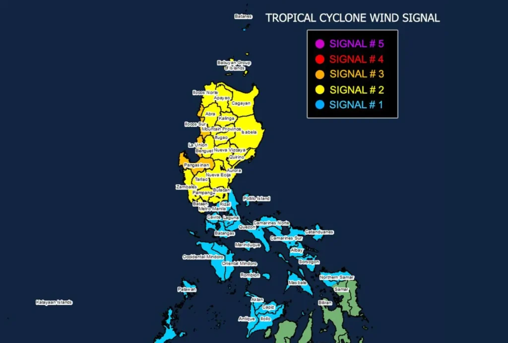
Signal No. 3 is raised in Ilocos Sur, La Union, and Pangasinan, where storm-force winds between 89 to 117 km/h pose a moderate to significant threat to life and property. These areas should expect significant impacts within the next 18 hours.
Signal No. 2 is hoisted over a broader region, including parts of Northern and Central Luzon, such as Cagayan, Isabela, and Nueva Vizcaya. Winds in these areas will range between 62 to 88 km/h, with moderate impacts expected.
Signal No. 1 is in effect for Metro Manila and surrounding provinces, as well as parts of Visayas, where strong winds of 39 to 61 km/h may cause minimal to minor damage. Mariners in these areas are warned to stay on alert.
Coastal Hazards and Sea Conditions
A Gale Warning remains in place across Luzon and parts of the Visayas, with sea travel extremely risky. In the Ilocos Region, wave heights could reach up to 7 meters. Other areas, including Zambales and Pangasinan, may experience waves as high as 6 meters, with the western seaboards of Batangas and Bataan similarly affected.
Coastal communities in Ilocos Sur, La Union, and Pangasinan should also prepare for a possible storm surge with heights ranging from 1.0 to 2.0 meters, threatening low-lying areas in the next 48 hours.
Outlook
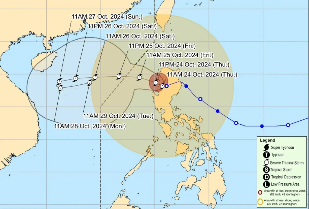
Kristine is expected to continue its westward track across the West Philippine Sea and exit the Philippine Area of Responsibility (PAR) by tomorrow afternoon. However, forecasts suggest a possible re-entry later in the week due to a developing tropical depression east of the PAR region.
Stay tuned for further updates and continue to monitor advisories, especially those residing in high-risk areas. The next bulletin will be issued at 8:00 PM today.