Typhoon Julian, locally known as Krathon, has intensified significantly and poses a severe threat to the Batanes and Babuyan Islands.
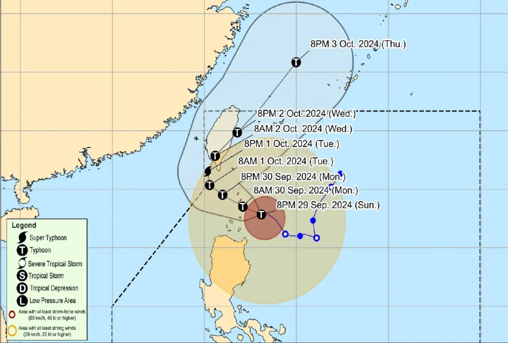
The latest bulletin from the Philippine Atmospheric, Geophysical, and Astronomical Services Administration (PAGASA) reports that Julian’s center is currently located approximately 125 kilometers southeast of Basco, Batanes, with maximum sustained winds of 150 km/h and gusts reaching up to 187 km/h.
Current Situation:
- Location of Typhoon: 125 km Southeast of Basco, Batanes (19.7°N, 122.9°E)
- Intensity: Maximum sustained winds of 150 km/h; gusts up to 187 km/h; central pressure at 960 hPa.
- Movement: Westward at 15 km/h.
- Wind Extent: Strong to typhoon-force winds extend up to 520 km from the center.
Tropical Cyclone Wind Signals (TCWS) in Effect:

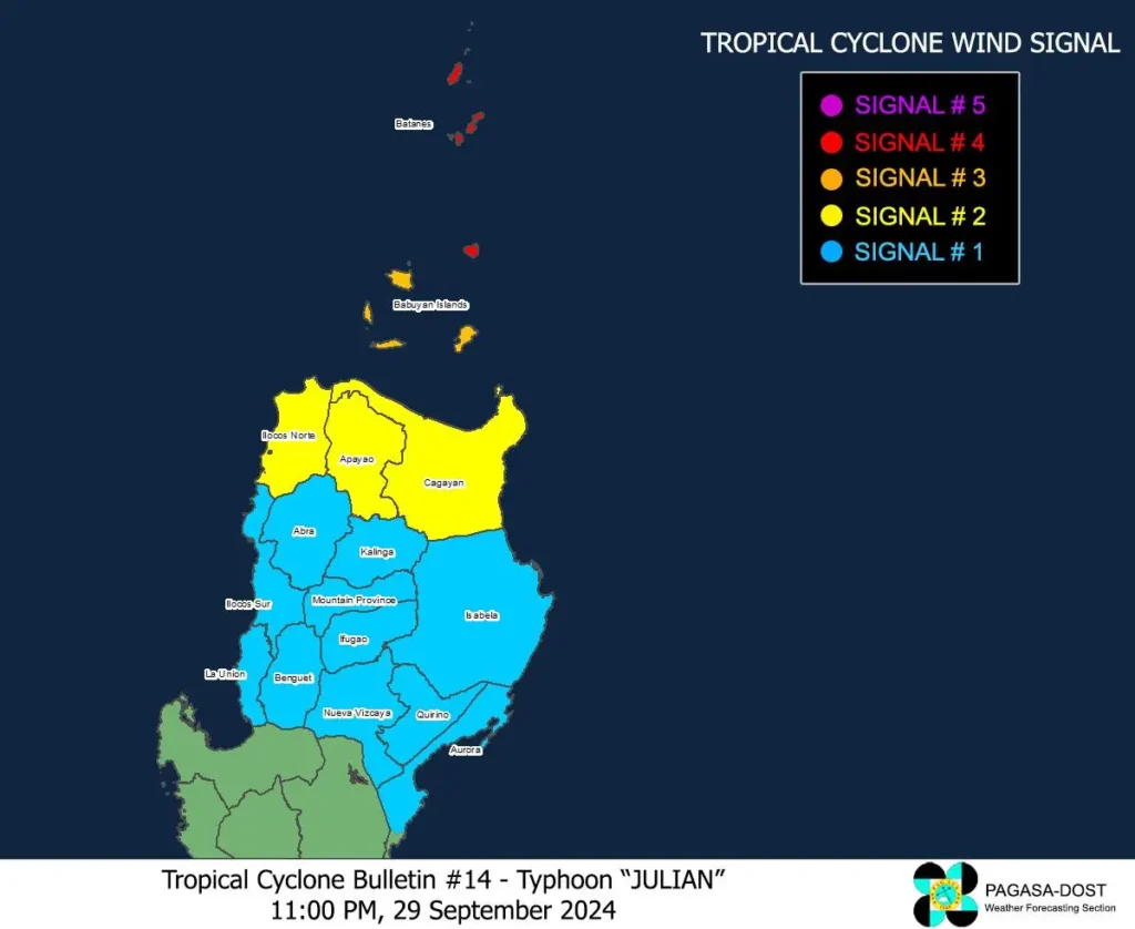
- TCWS No. 4:
- Affected Areas: Batanes and northeastern Babuyan Islands
- Wind Threat: Typhoon-force winds (118 to 184 km/h)
- Warning Lead Time: 12 hours
- Impact: Significant to severe threat to life and property
- TCWS No. 3:
- Affected Areas: Rest of Babuyan Islands
- Wind Threat: Storm-force winds (89 to 117 km/h)
- Warning Lead Time: 18 hours
- Impact: Moderate to significant threat to life and property
- TCWS No. 2:
- Affected Areas: Mainland Cagayan, Apayao, Ilocos Norte
- Wind Threat: Gale-force winds (62 to 88 km/h)
- Warning Lead Time: 24 hours
- Impact: Minor to moderate threat to life and property
- TCWS No. 1:
- Affected Areas: Ilocos Sur, La Union, Abra, Kalinga, Ifugao, Mountain Province, Benguet, Isabela, Nueva Vizcaya, Quirino, and parts of Aurora
- Wind Threat: Strong winds (39 to 61 km/h)
- Warning Lead Time: 36 hours
- Impact: Minimal to minor threat to life and property
Heavy Rainfall and Flooding:
Residents are advised to prepare for heavy rainfall as indicated in Weather Advisory No. 14. There is a significant risk of life-threatening storm surges in low-lying coastal areas of Batanes, Babuyan Islands, and northern mainland Cagayan over the next 48 hours.
Coastal and Sea Conditions:
A gale warning has been issued for the northern and eastern seaboards of Northern Luzon, with expected rough sea conditions. Mariners are urged to remain in port or seek safe shelter due to the high risk associated with sea travel.
Forecast Track:

Typhoon Julian is expected to continue its west-northwestward movement through Tuesday morning, potentially making landfall near Batanes on September 30.
Forecast models indicate that Julian may intensify to a super typhoon category before impacting southern Taiwan.
Public Advisory:
Authorities and residents in affected areas are strongly urged to take all necessary precautions to protect life and property. Local disaster management offices are advised to implement evacuation and safety protocols where necessary.
The next tropical cyclone bulletin will be issued at 2:00 AM tomorrow. Stay tuned for further updates and heed all warnings from local authorities.
For specific local updates, please monitor communications from your regional PAGASA services.
