
25 October 2024, 5:00 AM — Severe Tropical Storm Kristine (international name: Trami) continues to maintain its strength, accelerating west northwestward over the sea west of Northern Luzon.
As of 4:00 AM today, Kristine was located approximately 125 km west northwest of Bacnotan, La Union, packing maximum sustained winds of 95 km/h near the center and gusts reaching up to 115 km/h.
Storm Movement and Impact
Kristine is moving west northwestward at 25 km/h and is expected to exit the Philippine Area of Responsibility (PAR) later this afternoon.
The storm continues to bring strong to gale-force winds extending up to 730 km from its center, affecting large portions of Luzon.
Tropical Cyclone Wind Signals (TCWS) in Effect
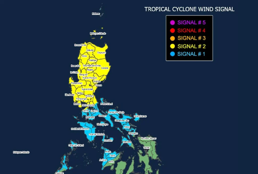
TCWS No. 2 is hoisted over several regions in Luzon, including Cagayan, Babuyan Islands, Ilocos Norte, Ilocos Sur, La Union, Metro Manila, and portions of Cavite, Rizal, and Quezon. These areas should brace for gale-force winds of 62 to 88 km/h, posing minor to moderate risks to life and property within the next 24 hours.
TCWS No. 1 is raised in Batanes, the rest of Cavite, Batangas, Laguna, Mindoro, and parts of Visayas, including Aklan, Capiz, and Antique. Winds of 39 to 61 km/h are expected, with minimal to minor impacts.
Other Hazards
- Heavy Rainfall: Kristine continues to dump heavy rains across parts of Luzon and Visayas, with localized flooding and landslides possible in low-lying and mountainous areas.
- Coastal Inundation: A storm surge risk of 1.0 to 2.0 meters above normal tide levels threatens low-lying coastal communities in Ilocos Sur, La Union, Pangasinan, and Zambales.
- Sea Conditions: Very rough seas, with waves reaching up to 7.0 meters, are forecast over the seaboards of Zambales and Pangasinan. Gale warnings are in place, and mariners are advised to remain in port or seek shelter.
Track and Intensity Outlook
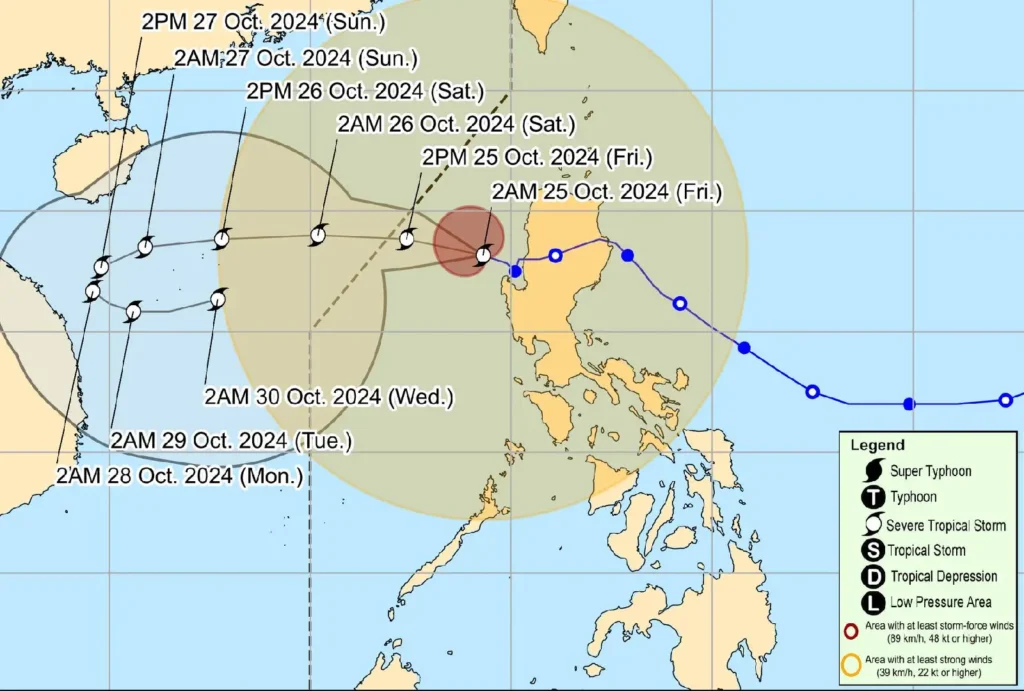
Kristine is expected to continue westward and exit PAR this afternoon. However, there is a developing scenario that could see the storm looping back towards the PAR region later this weekend, depending on the behavior of another weather disturbance to the east.
While Kristine may remain a severe tropical storm for the next five days, the possibility of intensifying into a typhoon is not ruled out.
Residents and disaster response teams in affected areas are urged to take necessary precautions, including evacuating from high-risk zones and monitoring updates from local authorities.