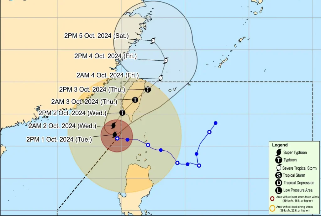
Super Typhoon Julian (international name: KRATHON) continues to demonstrate its immense power as it starts to recurve north-northwestward, heading towards Taiwan.
The eye of Julian was located 245 km west of Itbayat, Batanes, with maximum sustained winds of 195 km/h near the center and gusts reaching 240 km/h.
Its central pressure remains at 915 hPa, signifying its formidable intensity.
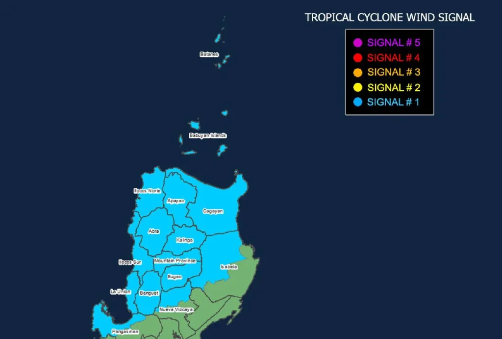
Tropical Cyclone Wind Signals Raised

Tropical Cyclone Wind Signal No. 1 is currently in effect over several parts of Luzon, including Ilocos Norte, Ilocos Sur, La Union, Batanes, Apayao, Abra, Kalinga, and Benguet, among others.
Under Signal No. 1, areas are expected to experience winds between 39 to 61 km/h within 36 hours. While these winds pose a minimal threat, residents should remain vigilant, particularly in coastal and upland regions.
Heavy Rainfall and Strong Winds Expected
Super Typhoon Julian’s outer winds are affecting parts of Northern Luzon, bringing strong to gale-force gusts over the Ilocos Region, Cordillera Administrative Region (CAR), and portions of mainland Cagayan and Isabela.
These areas are likely to experience heavy rains and powerful gusts today and into tomorrow.
Additionally, the Philippines Atmospheric, Geophysical, and Astronomical Services Administration (PAGASA) warns of severe winds in the coming days, especially for coastal areas, as Julian moves closer to Taiwan.
Dangerous Sea Conditions
A Gale Warning has been raised over the northern seaboard of Northern Luzon, where waves as high as 6 meters are expected.
The waters around Batanes, the Babuyan Islands, and Ilocos Norte are particularly treacherous, with sea conditions remaining very rough.
Sea travel is highly discouraged for all types of vessels, with mariners advised to seek shelter in safe ports.
Track and Landfall Outlook

Julian is forecasted to make landfall along the southwestern coast of Taiwan by tomorrow afternoon.
After crossing Taiwan’s mountainous terrain, Julian is expected to weaken into a severe tropical storm before exiting the Philippine Area of Responsibility by Thursday or Friday.
Despite the weakening, PAGASA warns that there may still be sudden changes in the forecast track.
Safety and Preparations
Authorities are urging the public, especially those in areas highly susceptible to flooding and landslides, to take necessary precautions and adhere to local evacuation orders.
Residents in affected regions should continue monitoring weather updates from PAGASA.
As Super Typhoon Julian continues to impact Northern Luzon and approaches Taiwan, disaster risk reduction offices are mobilizing resources to ensure the safety of communities at risk.
