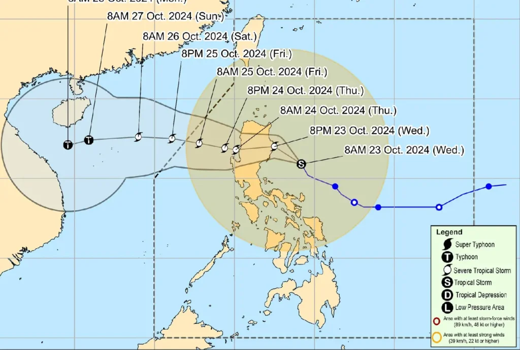
As of 10:00 AM, the center of Tropical Storm Kristine was located approximately 200 km east of Casiguran, Aurora, or 255 km east of Baler, Aurora (16.1°N, 124.0°E). The storm has accelerated slightly, moving north-northwestward at 30 km/h.
Tropical Storm Kristine maintains its strength with maximum sustained winds of 85 km/h near the center and gustiness of up to 105 km/h.
The central pressure is recorded at 985 hPa. Gale-force winds extend outwards up to 850 km from the center, affecting several regions.
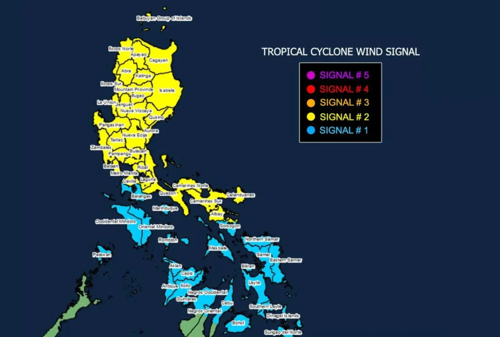
Tropical Cyclone Wind Signals in Effect

- TCWS No. 2: Gale-force winds (62-88 km/h) are expected in the next 24 hours in parts of Luzon, including Ilocos Norte, Ilocos Sur, Pangasinan, and Metro Manila, as well as the Bicol Region and parts of Visayas. Residents in these areas may experience minor to moderate threats to life and property.
- TCWS No. 1: Strong winds (39-61 km/h) are forecast within 36 hours for parts of Luzon, Visayas, and Mindanao, including Batangas, Masbate, Iloilo, and Dinagat Islands, among others.
Potential Impacts
- Severe Winds: Gale-force winds are expected in coastal and upland areas exposed to the winds, while stronger local winds may affect other regions.
- Heavy Rainfall: Refer to Weather Advisory No. 12 for further details regarding the rainfall forecast.
Coastal Hazards and Sea Conditions
A Gale Warning remains in effect for the seaboards of Luzon and Visayas, with sea conditions reaching up to 8.0 meters in some areas, including the seaboards of Cagayan Valley and Ilocos Region.
Mariners are strongly advised to remain in port or seek shelter until conditions improve.
Track and Forecast

Kristine is expected to continue moving northwestward for the next 12 hours before turning westward.
Landfall is projected over Isabela tonight, with the storm crossing Northern Luzon before exiting the Philippine Area of Responsibility (PAR) on Friday, October 25.
Kristine may intensify into a severe tropical storm before landfall and could re-intensify over the West Philippine Sea.
Residents in affected areas are advised to remain vigilant, follow local evacuation orders, and prepare for the potential impacts of the storm.
