
Typhoon Julian (international name: KRATHON) continues to weaken as it moves northeastward toward Taiwan.
As of 10:00 PM, the center of the storm was located 270 km west-northwest of Itbayat, Batanes, outside the Philippine Area of Responsibility (PAR).
Despite exiting PAR, Typhoon Julian still poses minimal threats to some parts of Northern Luzon, particularly the Batanes and Babuyan Islands.
Typhoon Details:
- Location: 270 km West-Northwest of Itbayat, Batanes (22.0°N, 119.6°E)
- Maximum Winds: 155 km/h near the center, with gusts up to 190 km/h
- Movement: Slow northeastward
- Wind Radius: Strong to typhoon-force winds extend up to 380 km from the center
Tropical Cyclone Wind Signals (TCWS) in Effect:
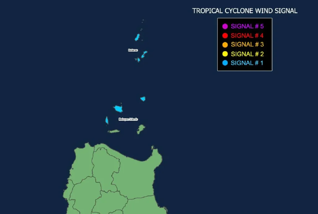
- Signal No. 1: Batanes and Babuyan Islands
- Winds of 39-61 km/h expected within 36 hours
- Minimal to minor damage to life and property expected
Coastal Waters and Gale Warning:
The northern seaboards of Batanes and Babuyan Islands are currently under a gale warning, with seas expected to reach heights of up to 4.5 meters.
Mariners are advised to avoid sea travel in these areas, as conditions are extremely risky for small seacrafts and motorbancas.
The seaboards of Ilocos Norte, mainland Cagayan, and parts of Zambales and Lubang Islands are also experiencing moderate to rough seas, with waves ranging from 2.5 to 4 meters.
Typhoon Julian’s Track and Forecast:
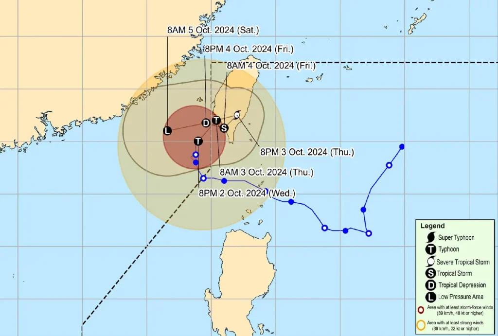
Typhoon Julian is forecast to make landfall on the southwestern coast of Taiwan tomorrow morning, October 3. Due to the cooler ocean waters and incoming northeasterly winds, it will continue to weaken as it nears Taiwan.
The storm is expected to become a tropical depression and could potentially downgrade to a remnant low after landfall.
Though the typhoon’s impact on the Philippines is minimal, residents of Batanes and nearby areas are advised to remain vigilant for strong winds and rough seas.
Disaster risk reduction offices and local officials have been advised to continue monitoring the situation closely.
Sea Travel Risks:
Mariners, particularly those with smaller vessels, are urged to seek safe shelter due to hazardous sea conditions, especially in northern Luzon.
Stay tuned to PAGASA’s updates for the latest weather advisories and evacuation recommendations.