
At 5:00 AM today, PAGASA issued Tropical Cyclone Bulletin No. 16, warning that Typhoon Julian continues to intensify as it moves over the Balintang Channel.
The center of the typhoon was located over the coastal waters of Balintang Island, Calayan, Cagayan (19.9°N, 122.2°E) as of 4:00 AM.
Typhoon Julian is packing maximum sustained winds of 155 km/h near the center, gusts reaching up to 190 km/h, and a central pressure of 950 hPa.
The typhoon is moving westward at a slower speed of 10 km/h, with strong to typhoon-force winds extending up to 560 km from the center.
Wind Signals and Impacts:
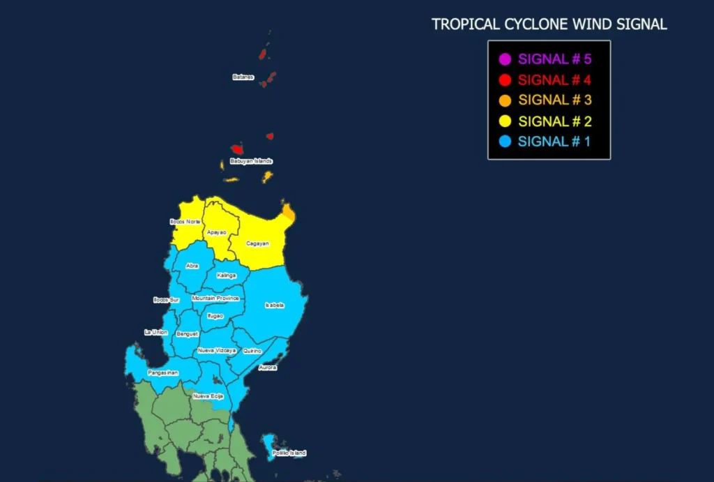
- Tropical Cyclone Wind Signal No. 4 is raised over Batanes and the northern portion of Babuyan Islands. Winds ranging from 118 to 184 km/h will pose a significant to severe threat to life and property. These areas are expected to experience the brunt of Julian’s typhoon-force winds today.
- Signal No. 3 is in effect for the rest of the Babuyan Islands and northeastern mainland Cagayan, with storm-force winds between 89 to 117 km/h expected to impact these regions.
- Signal No. 2 has been hoisted for mainland Cagayan, Apayao, and Ilocos Norte, where winds will reach gale force (62 to 88 km/h), posing a moderate threat.
- Signal No. 1 covers Ilocos Sur, La Union, Pangasinan, and several other areas in Luzon. Winds here will be strong (39 to 61 km/h), with minor threats to life and property expected.
Other Hazards:
- Severe Winds: Typhoon-force winds will peak this morning through afternoon, with the strongest impacts expected in areas under Signal No. 4.
- Storm Surge: Low-lying coastal areas in Batanes, Babuyan Islands, and northern Cagayan are at moderate to high risk of life-threatening storm surges.
- Sea Conditions: Very high seas (up to 14 meters) are forecast over the seaboards of Batanes and Babuyan Islands, making sea travel extremely dangerous. Mariners are advised to seek shelter and avoid venturing out.
Track and Outlook:

Typhoon Julian is expected to continue its west-northwestward track, passing near Batanes and Babuyan Islands today.
The typhoon may make landfall in southern Taiwan by Wednesday.
It is forecast to intensify further, possibly reaching super typhoon status before curving northeastward.
PAGASA advises the public to stay informed and heed local evacuation orders as Julian’s impacts intensify.