
Typhoon Julian (international name: KRATHON) continues to strengthen as it moves northwestward over the Philippine Sea, east of Cagayan.
According to PAGASA’s 5:00 PM bulletin, the typhoon’s center was located 235 km east of Calayan, Cagayan, packing maximum sustained winds of 120 km/h, with gusts reaching up to 150 km/h.
Tropical Cyclone Wind Signals in Effect:
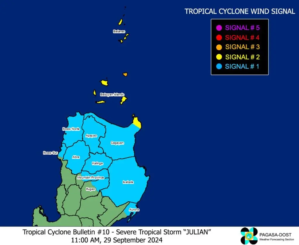
- Signal No. 3 (Gale-force winds of 89 to 117 km/h):
Batanes and Northeastern Babuyan Islands
Residents should prepare for moderate to significant threats to life and property. - Signal No. 2 (Gale-force winds of 62 to 88 km/h):
Mainland Cagayan, Rest of Babuyan Islands, Apayao, Northern and Central Ilocos Norte
Expect minor to moderate threats in these areas. - Signal No. 1 (Strong winds of 39 to 61 km/h):
Ilocos Sur, La Union, Abra, Kalinga, Isabela, Aurora (northern and central portions), and parts of Benguet and Ifugao
Possible minimal to minor impacts from strong winds are anticipated.
Rainfall and Wind Hazards
PAGASA warns of heavy rainfall over areas under the typhoon’s influence, with the most intense rains expected over Northern Luzon. Coastal areas in Batanes, Cagayan, and Ilocos Norte should also brace for moderate to significant storm surges over the next 48 hours.
Strong winds may further intensify over the next 24 to 36 hours as Julian approaches Batanes and Babuyan Islands, where it could make landfall or pass close by. It is not ruled out that the typhoon could develop into a super typhoon.
Sea Conditions and Gale Warnings
- Very Rough Seas
Batanes seaboards may experience waves up to 9 meters, while Babuyan Islands could see waves as high as 8 meters. - Coastal waters of Northern Luzon, particularly Cagayan and Ilocos Norte, will face rough conditions of up to 4.5 meters.
- PAGASA advises mariners to stay in port and avoid sea travel, especially small vessels and motorized boats, as conditions remain highly dangerous.
Track and Outlook
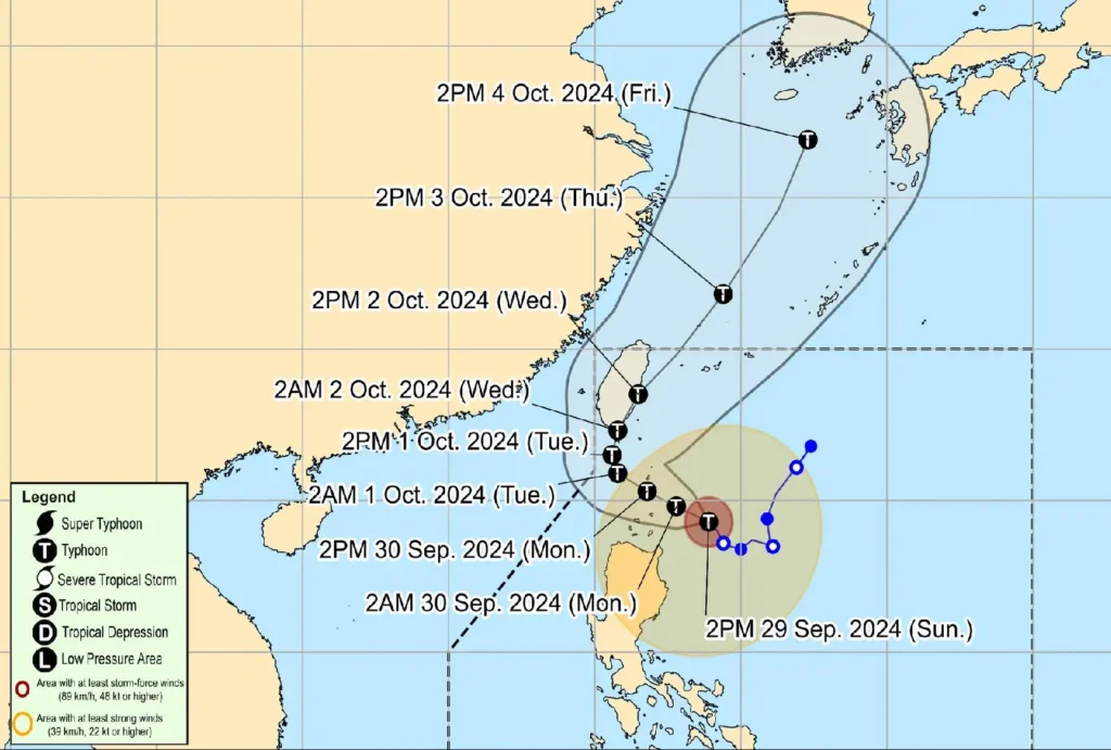
Typhoon Julian is expected to track west-northwest towards Batanes and Babuyan Islands and then accelerate northward towards Taiwan.
Residents in affected areas are urged to monitor local updates and follow evacuation orders when necessary.
Local governments, particularly in high-risk areas, are advised to remain vigilant and coordinate disaster response efforts to ensure public safety.